Manchester Victoria

On 4th May 1844 the first train of the Liverpool & Manchester Railway (L&MR) entered the new Manchester terminus at Hunt's Bank. The station was situated between a workhouse and a cemetery and approached by road up an incline from Great Ducie Street. The train entered via a bridge across the Irwell having traversed Salford on a raised viaduct in part alongside the Manchester & Bolton Railway. The train itself was dressed with flags but this was the only outward sign of celebration. The same day Manchester Liverpool Road, the former passenger terminus, became exclusively a goods station.

manc victoria photo ext
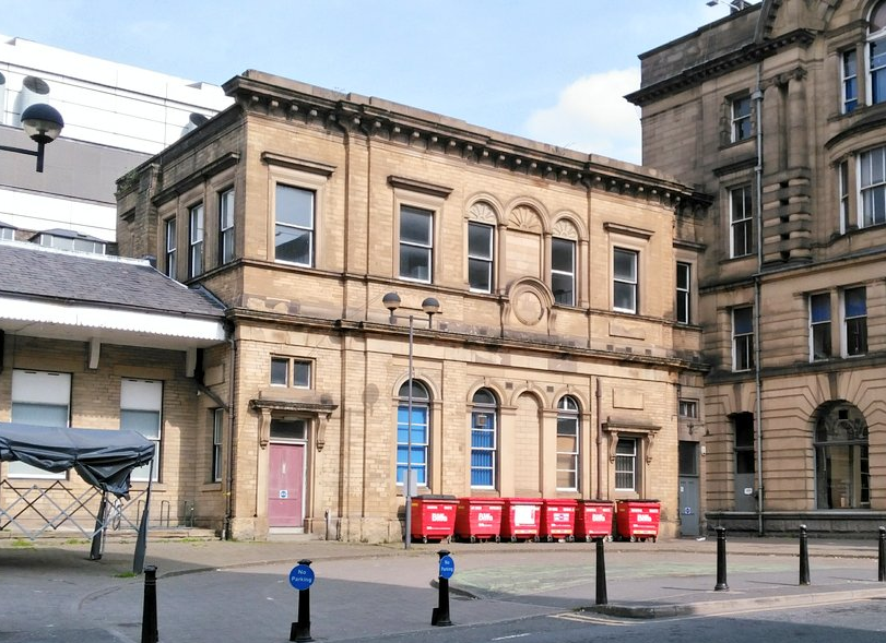
Fig: The refreshment room of the original station forms the first storey of the block by the red bins. An additional bay was later added to the left of the original five as well as the second storey.

In fact, Victoria station (as it had become known after a suggestion by a shareholder) had been open since 1st January but only to trains of the Manchester & Leeds Railway (M&LR) Company, the company that had built and still owned the station. Previously the company had used a station just over a mile to the east at Miles Platting (Oldham Road) and, while that station also went over to goods, many of the company administrative functions remained there as well.

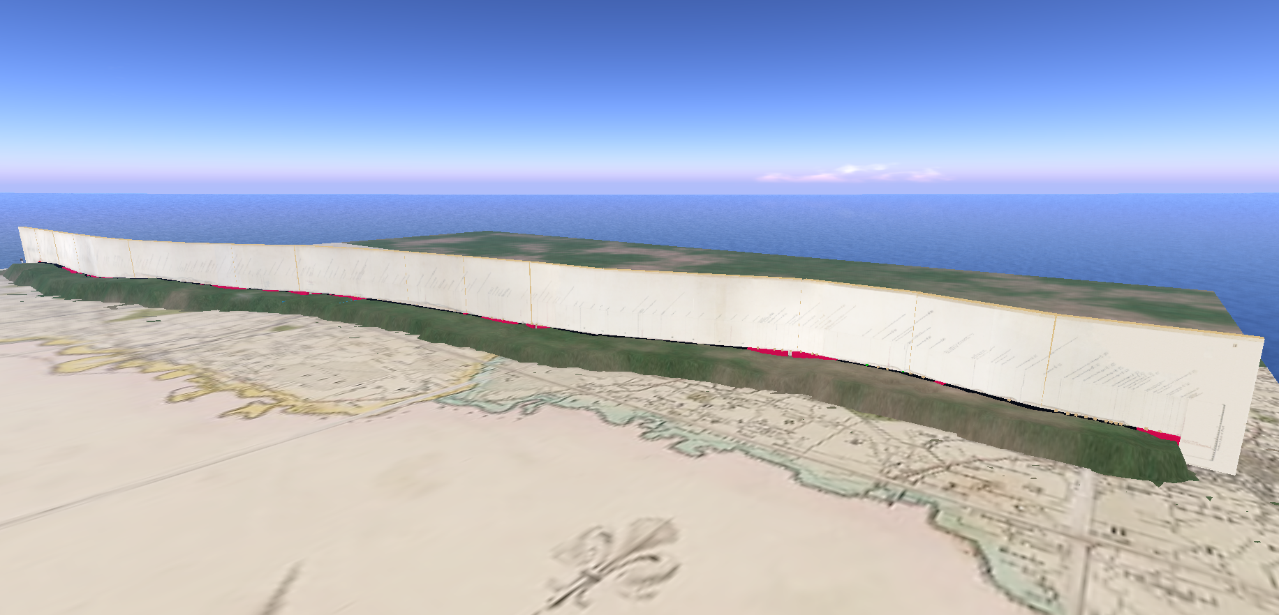
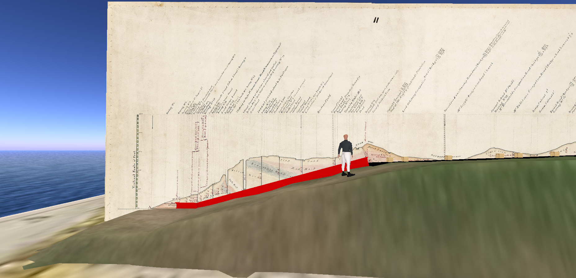
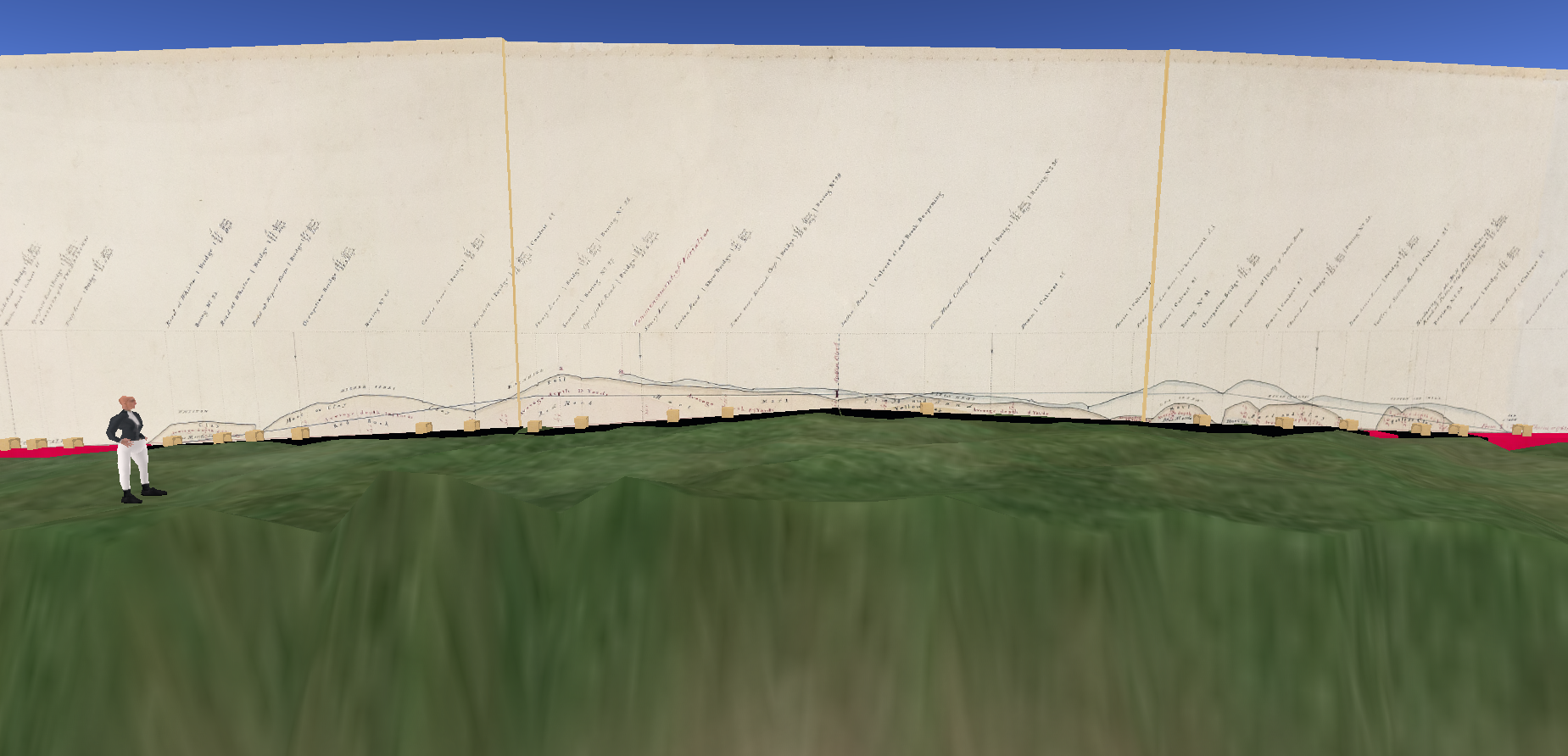
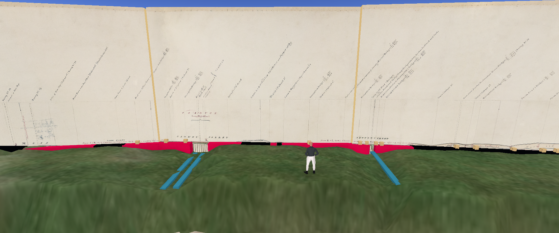
As ever, a work-in-progress and some conjecture…

(Belatedly, I discovered a digitised album of plans which have yet to be incorporated).

The inclined plane

The M&LR extension west from Miles Platting to Victoria involved a gradient and trains were to be worked into Victoria by a stationary engine that powered a continuous rope haulage system. Trains would be led into the station by a pilot wagon attached to the rope. On departure for Leeds the pilot would be coupled to the rear of trains leaving the station down the incline with the rope providing additional braking during the gravity run in addition to the brake on the pilot itself. Note, however, that the gradient reversed subsequently with the rope pulling the train up into the station at Miles Platting.

The system was coordinated between the two stations by telegraph. However, rope haulage was not working at the time of Victoria station's opening and, as was often the case, banking locomotives were frequently used instead.

The station

Victoria was owned by the M&LR but as with many large termini or stations at junctions was shared with other companies, including in this case the L&MR. Indeed, the plans published in The Builder are symmetrical about the shared refreshment room with the M&LR occupying the eastern half towards Leeds and the L&MR the western half towards Liverpool. The central refreshment room was operated independently by the restauranteur Vantini & Morigy (the former also managed the North Euston Hotel at Fleetwood).

manchester victoria ex builder 2 nb 256 x 36ft (2)
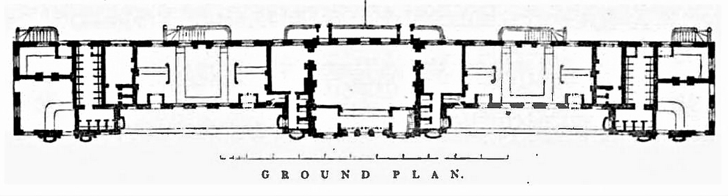
Fig: Plans published in The Builder for Liverpool Victoria station. The refreshment room is central and moving out from there in either direction (and speculating) there is the first and second class Ladies' Waiting Room, Booking Hall (one side for first and second class, the other for third class), general Ladies' Waiting Room, i.e. third class, Gentlemens Lavatories (first and second class), and in the wing pavillions a parcels office and superintendent's office. Third class and staff facilities were provided in the basement accessed via area steps on the platform.

The station architect was the Principal Engineer of the M&LR, none other than George Stephenson who had, of course, previously acted in a similar capacity for the L&MR. The primary responsibility, however, fell on his assistant from those Liverpool days, Thomas Longridge Gooch, and it is plausible that Gooch or his assistants carried out much of the detailed design.

Unlike Crown Street, plans for Victoria apparently exist in the Greater Manchester Archives and the station has been the subject of an eponymous book by Tony Wray. While I have yet to hunt these down, Wray has compiled a useful archive regarding the LYR (pdf) which deals in passing with the early days of Victoria station.

The visual record

The external appearance of the original station is recorded in The Builder. There are several early images, including one by Kirkham apparently made on behalf of the contractor Thomas Brogden.

In 1845 AF Tait produced a series of high quality views of the M&LR that included the interior and exterior of the station that will be mentioned subsequently. A view by CW Clennell shows two small lodges to the east that govern access to a street carriage park and loading bay. There is also an extension, most likely the telegraph office governing the inclined plane.

manchester victoria ex builder (2)
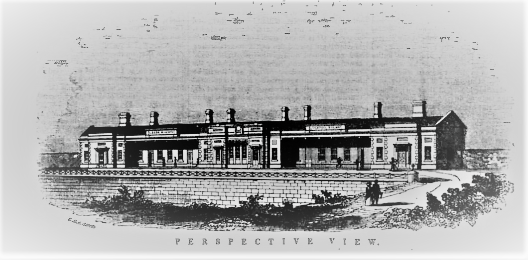
Fig: The exterior of Victoria station as depicted in The Builder. Hunt's Bank runs down on the left where a staircase was later provided for LNWR passengers as a shortcut.

Little of the original station exists apart from a somewhat modified refreshment room now used by staff. Originally it was a single storey and five bays wide. An additional bay may have been added later at the same time as the second storey. The third class refreshment room and staff facilities in the basement may also persist in some fashion?

Destination boards can be seen on the canopy above the booking offices in Tait's print of the exterior: Derby, Leeds, Selby and Hull are evident with others besides.

The Booking Halls

The twin Booking Halls again have a symmetrical layout with an office space bounded by a counter on either side running the width of the building, one for third class passengers and the other for first and second class. Each counter had its own entrance from the street and exit onto the platform with an additional counter facing the passengers on entry at right angles to the other. This may have been an attempt to separate processing of passengers on arrival (a waylist of passenger names was normally compiled) from advance booking. First and second class passengers may also have had their luggage collected at this stage for stowing on the roof; third class carriages had no roof storage and passengers received no assistance from porters. The relatively narrow space between the two counters may have regulated access to the platform.

However, the term Booking Hall in this case may have been something of a misnomer. The M&LR started limited service in 1839 and was, after the Newcastle & Carlisle, the first to adopt the standard cardboard ticketing system devised by Thomas Edmondson (pdf). This provided better accountability and faster processing by use of pre-printed tickets that were simply stamped with the date before use. According to Thomas (1980), the opening of the "Leeds Junction line" led to the use of such tickets on the Liverpool-Manchester line by the L&MR in May and the following month across its entire network.

A map from 1850 suggests that the arrangements shown in The Builder for the Booking Halls were subsequently modified.

Connecting Liverpool and Hull by rail

A continuous service between Hull and Manchester Oldham Road had been available since 1841 via trains operated by George Hudson's York & North Midland Railway. Determining the nature of the final link to Liverpool was, however, a protracted business given the often varying interests of railway companies, town councils, businessmen and populace more generally.

When the line beween two of England's premier ports finally opened in 1844, the track was owned by multiple companies. As we have seen, from Liverpool to Manchester employed the L&MR and from Manchester to Leeds Hunslet Lane the M&LR, albeit running on track owned by the North Midland Railway from Normanton to Leeds. Leeds to Hull was accomplished in two hops via the Leeds & Selby Railway and the Hull & Selby Railway, the terminus in Hull being at Manor House Street railway station adjacent to the Humber Dock.

Prior to the opening of Manchester Victoria, passengers would have needed to take a cab or omnibus from Manchester Liverpool Road to the M&LR station at Miles Platting. Even when Manchester Victoria opened passengers initially had to change trains there to complete the next stage of the journey to Leeds. However, pressure from passengers eventually told and through running of trains was negotiated.

The significance of the connection

The journey from Hull to Liverpool would later become a major route for mass emigration from Scandinavia, Germany and the Baltic states to America. However, in 1844 numbers making the crossing were relatively small, probably of the order of one thousand. However, in time the route would prove immensely useful for export of cotton goods from Manchester to the continent via Hull as well as of woollen goods from the West Riding to the Americas via Liverpool.

The interior and rolling stock

Tait's interior view shows five lines but only one platform albeit of roughly conventional height. Passengers were not expected to cross the lines and trains were accordingly worked from the single platform, albeit augmented by an additional bay for local services embedded in the platform at either end.

The lines were connected by a series of turnplates, including two sets adjacent to the refreshment room. This apparent redundancy may mark the limits of the two jurisdictions but they may also reflect the minor change in track gauge between the two companies (4ft 8.5in on the L&MR vs 4ft 9in on the M&LR).

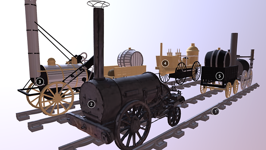
Several carriage types can be seen in Tait's interior view. To the left at the platform is what appears to be a relatively conventional first class carriage, painted yellow with coupe windows so probably belonging to the L&MR. Porters can be seen handling luggage still stored on the roof although there is no evidence of external seating for a guard.

On the third line to the right is a mixed train of what appear to be first class carriages and third class "Stanhope"-style wagons.

On the remaining two tracks we can see a rake of brown coaches in the distance (later LYR livery was teak and subsequently brown) and a rather curious rake of what might be first class cabriolet-style coaches in which the end compartments are optionally open, perhaps intended for summer use. These are yellow so presumably L&MR. The fact that L&MR rolling-stock occupies the eastern end of the shed and putative M&LR the western suggests that observance of the demarcation at the centre of the station was pragmatic.

There were additional sidings external to the northern wall accessed via a series of turnplates.

After the opening

In a short time, however, both companies would merge into larger groupings, the M&LR into the Lancashire & Yorkshire Railway (LYR), the L&MR into the London & North Western Railway (LNWR). The LNWR appears to have been much less relaxed about having to use a station owned by a rival concern and in 1884 would establish its own station, Manchester Exchange, to the immediate east of Victoria and sharing one platform, the longest in Europe.

The OpenSim model

The OpenSim model attempts to replicate the views presented by AF Tait in his 1845 publication. It differs in some respects from the outline plans, notably in the projection of the refreshment room onto the platform. Tait also plays down the presence of a bay inserted into the platform for use by local rather than through services. Although several sources refer to a bounding wall on the south as well as north side, it does not appear in any of the images and is hence omitted. The windows, doors and staircases on the platform are a work-in-progress. There is no evidence of tackle associated with the inclined plane, possibly because it was no longer used, so this is omitted.

manchester vic ext2
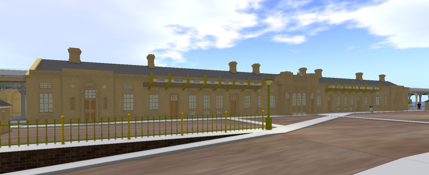
Fig: Exterior seen from Hunt's Bank Approach off Great Ducie Street. L&MR station is to the left, M&LR to the right.

manc vict int2
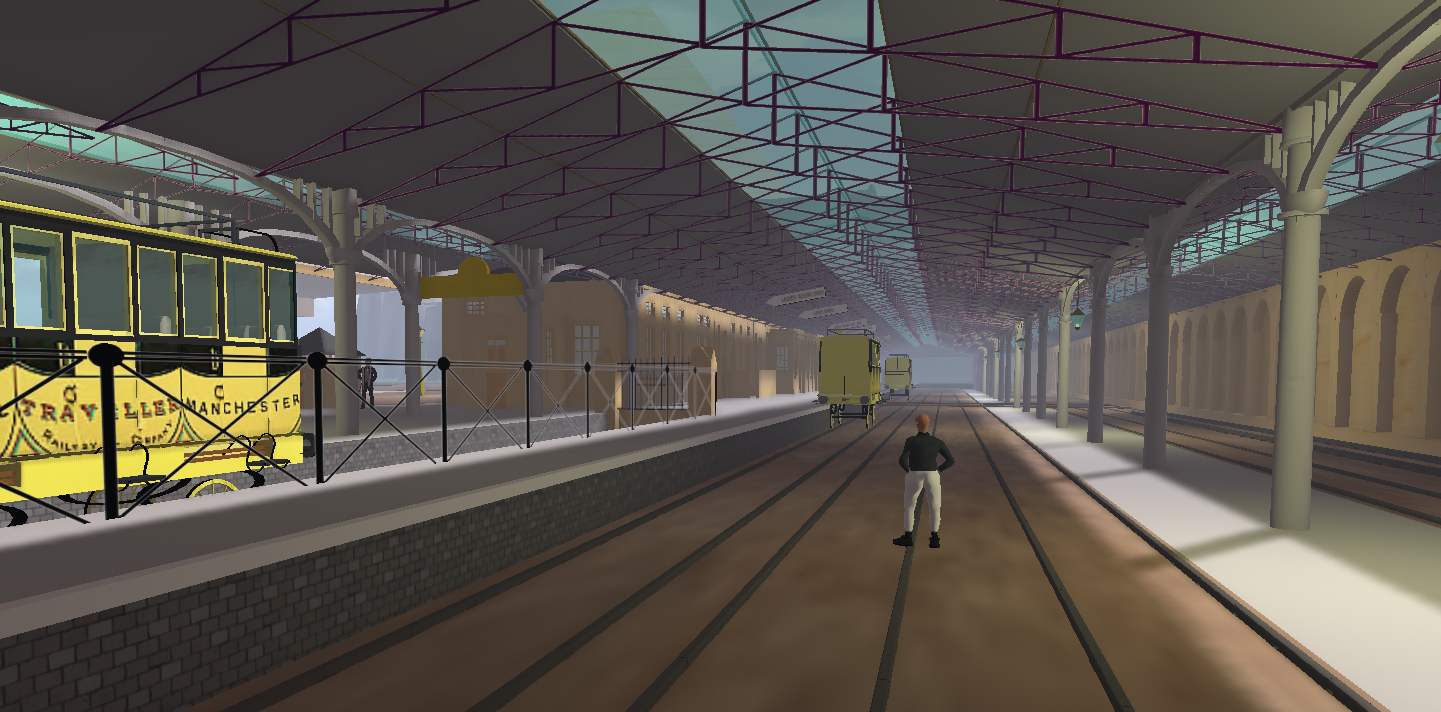
Fig: Interior of Manchester Victoria looking west towards Liverpool.

Telford's section

The archives of the Institution of Civil Engineers (ICE) contain the longitudinal section of the Liverpool & Manchester Railway (L&MR) used by Thomas Telford in his report to the Exchequer when the L&MR attempted to release the final tranche of its funding. On his recent visit to London Paul of the L&MR Trust digitised and reconstructed the section into a single enhanced image file.

I thought it would be interesting to render this in 3D using OpenSim so resized the image and then split it into 18 pieces and used these to texture 18 14x14 m panels mapped roughly onto a CC BY-NC-SA licensed 2D map of Lancashire from University of Manchester Archives. The 30-odd miles from the Mersey to Salford (the original intended terminus) were thus condensed into a virtual wall some 252 virtual metres in length.

I then adjusted the virtual terrain so that it followed the course denoted by the red line on the section (discussed below) except where embankments were to be constructed in which case red-shaded prims were added to show these.

telford1
Fig: General view of the OpenSim display which spans the breadth of a single region. The track is displayed at the foot of the vertical panels, either in black or, for embankments and bridges, in red.

The origin of the section

According to Thomas (1980), Telford's assistant, James Mills, found that the only section available in Liverpool during his inspection in December 1828 was the one drawn up by CB Vignoles for the Rennies in 1825 following Stephenson's dismissal. Mills therefore employed a draughtsman to make the copy now with ICE.

There is an immense amount of data in the section but I have no specialist technical knowledge so, as usual, some conjecture…

The Wapping tunnel

The section starts in Liverpool with the ascent of the Wapping tunnel from the goods station near the docks to Edge Hill. The small tunnel to the passenger terminus at Crown Street is not included (carriage of passengers was a secondary consideration) but there are some potentially interesting sidelights on the tunnel construction at that location.

Firstly, there is an air shaft in close proximity to the extant vent so there is support for the commonly supposed notion that a pre-existing shaft formed the basis for the vent.

telford2
Fig: The ascent of the Wapping tunnel (shown in red). Annotations on the panel above can be seen by manipulating the avatar camera.

However, there is also a "boring" roughly in the middle of the Crown Street field that may have been reused as part of the eye for construction of the tunnel as proposed previously. Note that the majority of borings were presumably carried out for geological purposes prior to construction. The assumption that some were subsequently reused seems reasonable but does not automatically follow. Indeed, the presence of nine air shafts covering the length of the tunnel is in much better agreement with the eight eyes originally put out to contract. The two shafts at Millfield are both specified at 20 feet although the section shows the air vent as 27.5 ft (the adjacent boring is similar) while at Edge Hill ("top of the tunnel") the depth of the boring is in closer agreement (35 ft vs 36 ft in the specification). The section lacks an air shaft at this site, the nearest being east of Smithdown Lane at the top of the current headshunt. Of course, extending the tunnel eastwards would lead into the Chatsworth Street cutting although much of the work there was completed relatively late.

The specification mentions one eye on "vacant ground east of Bedford Street" which presumably equates to an air shaft on the section, both at a depth of about 60 ft. The female penitentiary is also indicated and this is often cited as the location of a drift.

Blackburne Place, the site of a surviving ventilation shaft, is absent from the original specification but the location of both a boring and an air shaft.

In some cases borings and air shafts were in close proximity such as at the White Delf. The section confirms that these were at the level of the bottom of the quarry rather than the adjacent street. In this instance the proximity of the two shafts may have been a response to the limited space available either in a busy quarry or adjacent streets. Alternatively it may have signalled that the site was dual purpose.

Indeed, it is possible that the air shafts are highlighted on the section because they were intended to persist after the remaining sites had been closed up. Although the passage of trains might have been transient, staff would have had to undertake maintenance work on the track and haulage system. We also know from an account by the composer Felix Mendelssohn that staff had fires lit within the tunnel and that the tunnel was lit by gas, both observations supporting the ongoing presence of air shafts. [UPDATED 03/11/2019]

The red route

The section appears to map out two routes through Rainhill, the original (red) mapped by Vignoles and approved in the 1826 Act and an alternative subsequently adopted by the re-appointed Stephenson (black) with support from the Board of Directors but against the advice of the L&MR consulting engineer Josias Jessop.

The red route delivered a more level (and hence operationally cost-effective) railway but required a substantial cutting at Rainhill. The black route on the other hand follows the extant route which was originally to have required stationary engines at the Whiston and Sutton inclined planes which flanked the Rainhill Level. However, the subsequent Rainhill Trials suggested that travelling locomotives would suffice, if necessary either by splitting trains at the inclines or through assistance from a banking engine, i.e. locomotive.

Thomas (1980) suggests that Stephenson's adoption of the inclined planes may have been a strategem to prevent the use of horses for passenger services as specified by the Rennies. Stephenson, of course, had a vested interest in the use of locomotives as well as a profound belief in their being the best option for the future.

telford3
Fig: The track on the display follows the red route favoured by the Rennies. However, the costs of the construction of the huge cutting were such that the black route was adopted as can be seen on the display rising, reaching a level and subsequently falling again.

For the purposes of the display I have used the red route as it is historically interesting and leaves the black route visible above.

Bridges

There are some 91 bridges on the section, both over and under the railway, which are currently represented in the display by bridge icons on the track. Bridges were a significant cost element so it is possible that not all were built if alternative arrangements could be made. On the other hand footbridges were largely omitted from Booth's published list of 63 bridges. One footbridge that features early in the section is visible in the Bury prints of the Moorish Arch.

telford4
Fig: The embankments are shown in red leading to and from the viaducts as shown on the section for the Sankey valley (only 8 arches!) and at Newton. Note that bridges on the embankments will almost certainly be under-bridges.

Conclusion

The Telford section is a very valuable resource although some care needs to be taken in its interpretation as it represents an intermediate phase in development of the L&MR.

telford5
Fig: The section finishes at Salford. Passage across the Irwell and Water Street was a relatively late development.

The OpenSim display was put together in a few hours (terraforming was done manually and thus the principal time sink). The low resolution of the OpenSim terrain was a limiting factor but might be mitigated by building on a larger scale. The ability to program terrain height dynamically makes it feasible to consider simulation of the construction of the railway over time, at least at a gross level.

Acknowledgements

Many thanks to ICE and Paul of the L&MR Trust for access to the section.

The ducal carriage

On the opening day of the Liverpool & Manchester Railway in September 1830 there was a special running of eight trains to and from Manchester with the Prime Minister, the Duke of Wellington, in a train pulled by the locomotive Northumbrian. This was the newest engine and ran on the southern track so that it could stop at will and also act as a static base for review of the other trains as they passed. Unfortunately the stop at Parkside to review and water the engines was marked by a severe and ultimately fatal injury to William Huskisson MP when he was knocked down and run over by Rocket.

The list

For an event that commanded national attention there is a surprising degree of uncertainty about aspects of the opening day so the posting of a partial passenger list in a blog by a SIM Manchester author is of some interest. The blog suggests that there is no indication of the train to which passengers were assigned (Thomas [1980] provides a longer consolidated list but again without assignment). It is, however, headed "No.1" and with the Prime Minister among those listed it seems plausible that this is a list of those accompanying the Prime Minister in the ducal carriage.

Another intriguing feature is the numbering which, I would argue, may reflect a seating plan. Suggestive evidence for this is the otherwise arbitrary placing of Mrs Arbuthnot, Wellington's close friend and confidante, adjacent to the Prime Minister in the list.

Moreover, the list as presented is divided into two halves, 1-24 and 25-40. Assuming the structure is replicated in the original document, this may reflect the seating provision in the ducal carriage. Those named in the first part of the list would be seated on four benches, six per bench, running round the sides of the coach and those named in the second seated on two ottomans running the length of the coach, eight per ottoman seated back-to-back.

Opening_of_the_Liverpool_and_Manchester_Railway.jpg
Fig: Print by Isaac Shaw of departure of trains from the Grand Area. Wellington can be seen acknowledging the crowd by raising his hat at the front of the red carriage on the left.

Various sources suggest that Wellington was situated at the front of the ducal carriage, presumably at the end of the ottoman. In Shaw's sketch and print he can probably be identified as the individual at the front of the large 8-wheeler carriage who has a large nose and is raising his hat.

There is another useful constraint, namely that Huskisson and Wellington (who might reasonably be felt to harbour a mutual grudge), were unable to communicate directly until Huskisson debarked at Parkside and walked around to the front of the carriage. It may be that Shaw shows Huskisson as the man standing towards the rear of the train. It is notable how few of the 40 passengers Shaw manages to depict from the relatively acute angle and how the preponderence of those is female, almost as if he wanted the viewer to focus on the two males whose faces are readily visible.

liverpool railway ducal carriage.jpg
Fig: Although the artist has truncated the train to focus on major points of interest (and this version is cropped further), the picture shows a significantly larger number of passengers with males mostly at the edges. The presence of a soldier by the (double) door suggests additional staff may have travelled in the ducal carriage as close protection.

The ducal carriage was primarily occupied by dignitaries, mostly aristocrats, ambassadors and politicians, with their wives and daughters sitting on the ottoman. In some early pictures the ottoman is in two halves and this arrangement is adopted here. A second print by an unknown, possibly amateur, artist gives a better feel for this arrangement with the duke (in the cloak) shown at the front, men primarily down the sides and women behind them on the central ottomans.

ducal carriage ex museum liverpool.jpg
Fig: Untruncated version from Museum of Liverpool. The composition of the train accords with most descriptions apart from the additional wagon for the flag bearers. Unlike Shaw's version, it suggests one rather than two smaller carriages for the directors. Given that some directors were in charge of other trains, seating for 20 in one carriage should have sufficed unless, as Shaw appears to suggest, they were accompanied.

The seating plan

northumbrian seating plan.png
Fig: Names in italics represent substitutes likely to have been present on the day. Ottomans shown with red background.

With the possible exceptions of Wellington and Mrs Arbuthnot, the positions are hypothetical and based solely on consecutive numbering. They do, however, position Mr Arbuthnot close to his wife (for propriety) and the Dacres, Belgraves, Salisburys, Huskissons, Delameres and Stanleys are either adjacent to or relatively close to family members. The concentration of women on the inside (the widowed Lady Glengall is an exception) may have reflected a wish to shield their clothes from smuts and cinders.

Assuming she remained seated at Parkside, Mrs Huskisson would not have seen the accident that took place on the other side of the carriage. Those seated by Wellington on the other side are primarily politicians. Lord Wilton's proximity to Wellington may be due to his acting as a guide. Indeed, the proposed addition of Mrs Moss and Mrs Lawrence may have been intended to serve a similar purpose as well as fill gaps.

The identity of most of those present is clear with one exception, Miss Long (Thomas calls her Hon. Miss Long). One possibility is that she is a daughter of 1(https://www.historyofparliamentonline.org/volume/1820-1832/member/pole-tylney-long-wellesley-hon-william-1788-1857). At the time she would have been a ward of the duchess of Wellington so it is possible that she accompanied the duke though is seated here with young women of similar status.

OpenSim build

ducal carriage seating layout.jpg
Fig: Seating layout with a row of six bench seats down each half side and an ottoman in each half accommodating eight passengers sitting back-to-back.

A quick build suggests that the seating plan just about works based on 0.5x0.5 m per seat. Of course, those at the ends of the ottoman such as the duke can sit in either front-facing or sideways orientation. He can also make himself readily visible to crowds and passing trains.

While passing space in the aisles may be at a premium (as in a theatre), there are useful spaces at either end and the middle for socialising.

Not acounted for

The radical lawyer-turned-Whig politician Henry Brougham, later Lord Brougham and Vaux, was a supporter of the 1825 Railway Bill and earlier in 1812 had stood unsuccessfully against Canning for one of the Liverpool seats in Parliament. An ardent supporter of technical education for the working and artisan classes, in 1825 he opened the Liverpool Mechanics' Institute which was supported by many of the L&MR directors.

His memoirs make it clear that he was hoping to talk to Huskisson at Liverpool about a possible return to politics in conjunction with William Lamb, Viscount Melbourne. Melbourne, however, was unable to attend the opening as he was recovering from an operation on a carbuncle.

As he was well known to the directors, it may be that Brougham travelled with them rather than in the ducal carriage.

Conclusion

Further research is required to compare the list with those who actually travelled on the day (some substitutions have already been made). The motivation underpinning any seating plan may be of interest if it reflects the wishes of the directors to promote the railway or reward its supporters. The preponderance of males around the circumference may, however, simply reflect a wish to protect female dresses from smuts and embers emitted by the engine.

Further understanding of the composition and arrangement of the passengers in this carriage may be assisted by analysis of published diaries. Such were the numbers of dignitaries travelling that day that their absence from the ducal carriage is also a subject of interest.


  1. William Long Wellesley

The modern world started here: Rainhill, Part 2

Previously I visited Rainhill to give some contemporary context to the 1829 Rainhill Trials whose 190th anniversary is celebrated in 2019. In this belated follow-up I expand coverage to the running grounds east of the Skew Bridge. As ever, much conjecture, work-in-progress, etc…

About the Trials

The aim of the Rainhill Trials was to test steam locomotives under tightly controlled conditions on a simulated journey from Liverpool to Manchester and back again. A prize of £500 would be given to the winner deemed to have advanced the then state of locomotive development. Opinion among the board of the Liverpool & Manchester Railway (L&MR) was divided as to the best means of hauling trains with locomotives favoured by the Prinicipal Engineer, George Stephenson. However, others such as Cropper, a sceptic so far as Stephenson was concerned, preferred an unwieldy series of stationary winding engines. The Trials (0r Ordeal as they were also known) would resolve the pressing question of motive force with (rather optimistic) hopes of at least a partial opening in January 1830.

As the track was incomplete in 1829 the distance was achieved by locomotives running a 1.5 mile course from Rainhill to Lea Green, reversing back to the start and repeating the journey 10 times in the morning and a further 10 times in the afternoon. Engines were required to pull a load three times the weight of the engine. A weighbridge was provided at the start to determine the load which was made up of the fuel, water and crew as well as wagons containing variable amounts of stone. The course had the advantage that it was level and complete (apart initially from track) although it was bounded at the western end by the Whiston inclined plane and, more distantly, at the eastern end by the Sutton inclined plane. Both were candidates for stationary engines and it appears a start had been made on housing for the western one.

This post will focus on the context of the Trials rather than the day-by-day events which have been well-rehearsed elsewhere.

The seven bridges

Rainhill at the time was a small village, albeit with some industry (a glassworks) and a stable for some 240 horses used in coaching by the company of Bartholemew Bretherton. The part of the village adjacent to the course already lay at the intersection of two turnpike roads, the Liverpool-Warrington and Eccleston-Cronton, at Kendrick's Cross.

The best-known feature of the Rainhill course was the Skew Bridge carrying the Liverpool-Warrington turnpike but this was just one of four bridges shown on the late 1840s map, one of which was probably a footbridge off what is now Kendrick's Fold and Dee Road but then mostly a rough track. Although there were some 65 bridges and tunnels in Henry Booth's official list footbridges were included only under an aggregated head.

The bridges (in order, west to east): Stone(y) Lane, unnamed footbridge, Spring (Old) Lane, Rainhill (Skew) Bridge.

One discrepancy is that the map shows all apart from the Skew Bridge as being wooden while Booth states that the Spring (now Old) Lane bridge was ashlar, stone and brick. The Stone(y) Lane bridge was wooden with brick piers.

An 1831 engraving by Isaac Shaw shows two of the bridges west of the Skew Bridge in the background. The bridges are very different in appearance with the nearmost looking decidedly unwooden (and hence in accord with Booth's account) and the more distant looking like a footbridge (as expected). Whether you could really see all three from that vantage point is moot as another view, albeit from the other side of the track, shows only two bridges. The parsimonious Bury gives us only the Skew Bridge from his perspective (presumably looking east-to-west). In any event there is far more trackside vegetation now to obscure any comparable view.

rainhill_bridge_shaw.jpg
Fig: Rainhill Bridge by Shaw (Science Museum CC NC-BY-SA 4.0). Looking west towards Liverpool, locomotive Planet pulling a luggage train. The bugle may be signalling the approach to the level crossing and adjacent station some 200 m further on.

rainhill skew bridge looking west.jpg
Fig: A similar, if more distant, view taken from the barrier at the end of the station platform

Shaw's print also reinforces the fact that the track ran in a gentle curve through a cutting on its way into Rainhill. While the Trials were held at Rainhill because the track was level, this was only because some 220,000 cubic yards had already been excavated. Moreover, east of Rainhill there is now a low embankment on the way into Lea Green.

An external assessor, Josiah Jessop, had recommended a deep cutting at Rainhill to avoid the 1:96 gradients at Whiston and Sutton but Stephenson was against this on grounds of cost and delay. This meant that a decision had to be made to manage the inclined planes by means of either stationary or banking engines, locomotives that would push or assist braking from the rear of large luggage (goods) trains. On the first morning of the trials the directors assembled at Huyton and travelled up the Whiston incline to Rainhill in a train hauled by Rocket with Stephenson at the controls. The decision in favour of banking engines was as good as made.

As far as the bridges are concerned, all but the Skew Bridge appear to have been subsequently replaced. Stoney Lane became a skew bridge to avoid the awkward Z curve otherwise imposed on the road while the Skew Bridge itself was widened by 4 feet in 1963 to add a second footpath. Three additional footbridges now lie east of the Skew Bridge, including one on the station and one at the junction of Victoria Street and Tasker Terrace, the site of the first station and former level-crossing. A final footbridge appears to maintain a right of way between Ritherup north of the track and the recreation ground to the south although the footpath itself is hard to discern.

These days the footbridges allow visitors to see something of the track, the remaining road bridges having had their sidewalls raised following overhead electrification.

The crowd

The Trials had been widely advertised and according to reports there were something like 10-15000 people watching. The spectators were presumably concentrated to the east of the Skew Bridge, the nominated running grounds. If we take the lower number as more probable and assume they were present on both sides of the track for a distance of 1 mile, we would expect a density of about 3 people per metre. Talk of crowds suggests, however, that spectators may have been concentrated at particular points and hence to a degree managed.

Only part of the course has been modelled in OpenSim. The model shows the permanent way as being fenced off as it presumably was when the railway opened in 1830. This would be to keep animals off the tracks as well as humans. We know, however, that some 300 company employees acted as stewards, i.e. one every 20-ish metres if evenly distributed, so it is is possible that fencing was either partial, absent or thought likely to be ignored. Nevertheless, spectators were not allowed to cross the track unless authorised by the directors. Stewards are notably absent from all supposed images of the Trials. Newspaper reports suggest they were largely ineffectual.

The start of the course

The course started to the west of Rainhill where there was a small depot comprising a weighbridge and associated shed together with supplies of fuel, water and stone as makeweight.

The course itself was double track with one track extending down the Whiston inclined plane to Huyton. The trains under test did not turn so used just a single line. Famously, one engine over-ran the designated stopping-place on the return journey and continued a short way down the incline beyond. It seems likely that the second track provided logistical support for the depot as well as serving as backup for the trial runs and for exhibition, testing and "pleasure" rides.

The exhibition at the Rainhill Library has a useful map (the original dates to the 1929 centenary) of the start location in a cutting between the Stone(y) Lane and Spring (Old) Lane bridges. This is bisected by a footbridge with the starting post to the west and the first time point 220 yards further to the east.

The cutting at this point is substantially wider than elsewhere. It later included a siding with a watering station on the south side and to the north a passing siding used by banking engines assisting trains up and down the Whiston inclined plane. Given that these engines were mostly constrained to the incline, it makes sense that the location was relatively self-sufficient. The 1840s map shows a terrace of three cottages west of Stoney Lane Bridge and it seems likely that these were for railway workers associated with the watering station. However, the locomotives used for banking were housed at Whiston at the foot of the incline. The terrace had disappeared by 1850 when permanently stationed banking engines were presumably no longer required or located elsewhere.

Although the width of this area in 1829 is unclear, any extra space would doubtless have come in useful for the depot during the Trials and one can imagine space being required for the shed and associated materials and perhaps even for an additional siding. Once weighed, the engine and load were pushed to the running-in point. There was then a 220 yard run-in to the actual first post on the other side of the footbridge during which time the engine had a chance to get up to speed before timing began. There was a judge's tent located at the start line with Rastrick stationed at this end.

Caveat on post locations

The guidance to spectators specify that the running would take place on the Manchester side of the bridge which for the most part is true. The course was marked out by posts at 440 yard intervals. One was located at "the bridge" and it is assumed that this refers to the Skew Bridge. However, a contemporary account states that the course ended at the 10 mile post which suggests that the course was based in part on these prexisting markers. If their position was the same as in the 1840s, the bridge post would be more than 100 metres west of the Skew Bridge and could even refer to the Spring Lane bridge.

Either way, the track would pass under the Skew Bridge, the most acute on the line and the fourth most expensive to build after the two viaducts and the bridge in Manchester over the River Irwell. The Skew Bridge featured prominently in pictures by both Bury and Shaw. Given that it carried the Liverpool-Prescot-Warrington turnpike over the railway, it offered artists a chance to juxtapose the old and the new with stagecoaches passing above the trains.

Entertaining guests and locos: the grandstand area, buffet and local inns

Rainhill_Trials_in_the_Illustrated_London_News.jpg
Fig: The conjectural view of the grandstand

The next interval post was at the grandstand, a further 440 yards east of the Skew Bridge. However, the most common view of the Trials shows a grandstand next to the Skew Bridge. Thomas (1980) accordingly describes this image as conjectural and, indeed, It seems unlikely that it is contemporary, more an attempt to cram as many points of interest together as possible. Related images, possibly derivatives, show the same content from slightly different angles. It is generally hard to discern the angle of the skew and hence determine whether the grandstand is on the north or south side of the tracks although on balance the north side seems more likely.

The provenance of the image is unclear although it is included in the 1868 US edition of the biography of the Stephensons by Samuel Smiles. Others have assigned it to the Illustrated London News. This was first published in 1842 so again it is unlikely to be a contemporary record of events. Newspaper reports indicate that the grandstand was equidistant betweeen the two ends of the course and on the south side, in other words not by the bridge.

The grandstand (also referred to as a booth) was apparently provided for ladies only, presumably by invitation, with a band present to entertain them. The number accommodated is unknown. It is plausible that the grandstand was reserved for the wives of engineers, proprietors and select local dignitaries. On that basis its capacity might have been 150-200, i.e. relatively small.

rainhill french print.png
Fig: A copy of the "French print", probably a reconstruction but notably lacking the distant Skew Bridge.

A corner of the grandstand also features in a supposedly contemporary French engaving reproduced c.1902 by Nansouty. While there are again questionable details, it usefully gives a reverse view that is consistent with some textual descriptions. We know, for example, that there was a maintenance workshop, sheds for the engines (presumably behind the vantage point) and probably a tent for refreshments. The location is plausibly on the meadow to the east of the crossing with Eccleston Hill in the background. This places the grandstand south of the permanent way on what is now the recreation ground or, more likely, on the eastern edge of the adjacent cricket field.

This area is flatter than the northern side of the track and it would seem more likely that both the workshop and sheds were on this side. Whether invited guests crossed the track to a tent is plausible only if running ceased at lunchtime (as, admittedly, it probably did).

While the French print is consistent with the position of the marker post, it does have some issues. The image of Rocket is similar to that shown in the Illustrated London News save for the presence of a tender lacking a water barrel, an innovation more commonly associated with the Northumbrian locomotive of 1830. The 6-wheeled coach is somewhat incongruous as most carriages at the time seem to have had four.

The locomotives are also somewhat mysterious. While Sans Pareil can be made out on the other side of the track (with its leading tender), other obvious candidates are missing (Novelty, Cyclopede, Perseverance) and some unidentified, possibly generic, locomotives substituted. Of course, It is not unlikely that others might have been present, e.g. Lancashire Witch, Twin Sisters, although no sources mention this.

Accordingly, it seems unlikely that the French picture is contemporaneous although it has sufficient merit to suggest that it may portray either a reconstruction or a reenactment.

According to some accounts, the food provided was distinctly simple, just bread, cheese and beer. Small wonder then that the few local venues, the Rainhill Tavern presumably amongst them, did excellent trade and the latter (termed Railway Tavern by Thomas) set aside a room for the "better class of person" (it is now the Victoria Hotel). Nicholas Robinson, former Liverpool mayor and owner of Sudley, was commended for his foresight in renting a farmhouse in which to entertain his friends, possibly the nearby Ritherup Farm.

Other accounts suggest that Melling's works was hired for use as a workshop. A later photograph of the works bears some resemblance to the structure in the French picture but Melling's works was, in fact, located adjacent to the level crossing some 200 m west of the grandstand. It was in any case only opened in 1840 when the L&MR made Melling redundant. Prior to that it had been a glassworks.

A second inn or tavern is also mentioned in some accounts but not named. Whether this was the nearby Coach & Horses, if extant, or the more distant Ship Inn, the focus of Bretherton's coaching business, is unclear. Curiously an inn called the Coach & Horses features in the background of a sketch published in 1884 supposedly by James Nasmyth which, according to Anthony Dawson, shows the post-Trials Northumbrian mis-identified as Rocket. Although Nasmyth indeed claimed to have sketched the locomotive during the Trials, this version is presumably later and based on a sketch of Northumbrian made by Nasmyth on the day before the opening in 1830. The inn and branchline therefore probably represent later artistic embellishment.

The OpenSim build

The build is very provisional as almost no local research has been done and few contemporary resources are available online. However, one potentially useful image is derived from a 3D model built by a local primary school which shows part of Rainhill as it was in 1829.

rainhill recreation ground.JPG
Fig: Rainhill recreation ground, formerly a meadow, from the railway footbridge. Looking west, the grandstand area may have been beyond the hedge and trees to the left, now part of the cricket club. The meadow may have been used by spectators in addition to the area by the Skew Bridge (and probably others).

rainhill opensim model.jpg
Fig: OpenSim build of Rainhill at the time of the Trials based on the French print. Looking west, the Skew Bridge is in the far distance beyond the level crossing. A gatekeeper's lodge has been included. Although there is no evidence of one being built by this stage, the need to manage the crossing would become increasingly important. The minutes of the Board of Directors indicate that Stephenson was asked to move the gatehouse near Bourne's Colliery, presumably at Lea Green, on 12th July 1830, the reason being that it was too close to the track. It seems likely that the gatehouse at Rainhill would also have been in place by this time. The early station (which this became) was partially destroyed in a serious accident and subsequently rebuilt in the present location by the bridge.

rainhill opensim model from bridge.png
Fig: OpenSim model seen from the Skew Bridge looking east. The gates of the level crossing are evident and the grandstand area lies beyond and to the right. The glassworks are to the left and the Rainhill Tavern to the right.

Conclusion

While the locomotive performance at Rainhill was recorded in considerable detail, the visual record of the event appears generally suspect. The French print may be more compatible with what little was written at the time and is the basis for the current OpenSim build. However, additional sources are required for purposes of cross-checking and local archives may prove valuable in that regard.

Pictures of the Past: educating future railway engineers in late Georgian Liverpool

Pictures of the Past is the autobiography of railway engineer Francis H Grundy, better known to his brother-in-law at least as Henry. It describes his early years in Liverpool around the time of the construction of the Liverpool & Manchester Railway (L&MR) which opened in 1830. While many books mention the railway in passing, few describe in any detail the principal characters engaged in this groundbreaking enterprise. While there are likely many errors in Grundy's recollections, the book also provides some curious insights.

Oh yes, spoiler alert…

Introducing Henry

Grundy writes his story in 1879 from the perspective of a civil engineer who emigrated to Australia 20 years previously after spending some 23-26 years in the UK (the experiences in Australia are discussed in the book but not here). This suggests that he was born in 1833 which does not fit with the events covered. It is possible that the period in the UK excludes his education and upbringing which would perhaps put him in his early or mid-teens in 1833. Unfortunately, Grundy is evasive as to the date and place of his birth, although it seems reasonably clear that his formative years were spent in 1820s/30s Liverpool after his family moved from Manchester with Henry aged two. UPDATE: A Francis Henry Grundy was born 18th November 1821 and baptised the following year at the Unitarian Cross Street Chapel, Manchester. At the time his parents lived on Chorlton Road.

We are told that he lived on Parliament Street in a large house overlooking St James' cemetery and that his father was associated with the church. Indeed, the 1829 edition of Gore's directory shows the Rev John Grundy living at 45 Upper Parliament Street. Rev Grundy preached at the Paradise Street Unitarian Chapel with the more famous James Martineau who was greatly admired by Henry (he was somewhat intimidated by equally renowned sister Harriet). In 1835 Rev Grundy retired to Bridport, Dorset due to ill health. Henry had four sisters and three brothers.

Liverpool St James bury 2.png
Fig: St James's cemetery in 1831 by Thomas Talbot Bury. Stephenson's house on Upper Parliament Street is third from left in the distance. The Grundys may have lived in the large house first on the left.

Grundy's schooldays

Grundy talks of "returning from school down the long vista of Old Parliament Street" and of his teacher at the age of 6 as being a "Miss Hurry". Fast forward to 1831-2 (probably earlier, in fact) and Miss Hurry is teaching chemistry, biology and astronomy with memorably dramatic practical demonstrations. Henry regards her as a "good soul" (perhaps suggesting a relatively mature woman) and "ahead of her years" as far as her teaching methods were concerned. There is a letter mentioning a Miss Hurry written to her mother in 1829 by 9-year old Elizabeth Jane Roscoe, granddaughter of William Roscoe, and alluding to a ball at school.

Gore shows that in 1829 a Miss Jane Hurry taught at a boarding school at Windsor, a district on the edge of Toxteth Park which is indeed uphill from the house on (Upper) Parliament Street and close to the station at Crown Street. The school is associated with several teachers named Bradley who give their address as 1 Crown Street, Windsor. One of these may be a John Bradley who compiled school textbooks on astronomy and geography.

Crown Street at this time crossed Upper Parliament Street and ran a short distance along what is now Kingsley Road. Swire's map of 1823 shows just two buildings on Crown Street, both in this area and to the rear of where Windsor Terrace would shortly be. By 1854 the Bradleys have moved to a school and seminary in Whitfield Street off Park Road.

IMG_20180221_131759.jpg
Fig: Henry Grundy's school may have been located behind Windsor Terrace which formerly extended into the space occupied by the new build shown here on the corner of Upper Parliament Street and what is now Kingsley Road but was then an extension of Crown Street.

Miss Hurry's celebrity lodgers

For Henry, however, the most remarkable lessons are those given by one of Miss Hurry's lodgers, the L&MR engineer Joseph Locke. In what was surely a piece of improvised pantomime, Locke would sit behind Miss Hurry and mimic her movements during a lecture demonstration until in exasperation she quit the room at which stage he would take over the class, typically with disastrous results. Miss Hurry would then return and scold him for endangering her students after which Locke would declaim loftily that they would all have died for science and announce a half-day holiday. Locke's amusing interventions were necessarily infrequent as he was mostly working "double tides", i.e. day and night, on completing the L&MR.

Locke was responsible for the western end of the L&MR but resigned in December 1829 to undertake work on other Stephenson projects, notably in Stockport. This was probably a consequence of the discovery by directors that L&MR staff were working on Stephenson's non-L&MR projects in the Clayton Square office. Locke was replaced by Stephenson's personal secretary and draughtsman Thomas Longridge Gooch. Grundy identifies Gooch as another of Miss Hurry's lodgers which is curious as most accounts state that he lodged with the Stephensons. However, his replacement, Frederick Swanwick, presumably took Gooch's place in the Stephenson household in early 1830.

The only address in Gore for Miss Hurry is the boarding school so presumably she was resident on Crown Street and, if Locke were her lodger, this would provide an alternative explanation for Locke's earlier use of Crown Street as address in a letter to William Roscoe (who would now be a relatively near neighbour in Lodge Lane). This assumes, of course, that Locke stayed on in Liverpool while undertaking the work in Stockport. Clearly a location so close to the station would have been of considerable interest to the engineers who may also have benefited from arrangements for meals and laundry in what was probably quite a new build.

Grundy's opinion of Gooch is a little lukewarm, calling him a good, painstaking man though lacking in the originality and ambition shown by his younger brother, the more famous Sir Daniel. Once he qualifies as an articled engineer, Grundy encounters Gooch again in Yorkshire where both are working on a new railway. Grundy indicates that by this stage the somewhat staid Gooch was not averse to "a little jollity", i.e. drinking, in the evenings (an occupational hazard for railway engineers at the time) but on this occasion suffered a monumental hangover.

The Stephensons

The Grundys must have been near neighbours of George Stephenson at no. 31 (now 34) Upper Parliament Street. While "Old George" is mentioned several times, it is not clear that he was close to the Grundys while in Liverpool as Henry recounts a story of George in later years attempting to eject him from a train. Recognising George, Henry had deliberately acted as though he had no ticket and, while being thrown from the train, protested both his innocence (he had a ticket) and that George had failed to recognise him from a previous meeting three years previously. Although Grundy never visited George after he retired to Tapton House, the book has an interesting chapter by one of George's (unnamed) personal secretaries from that era. He confirms that George's limited literacy did not prevent him giving fluent and accurate dictation.

George Robert Stephenson, son of George's elder brother Robert, also appears to have been a pupil of Miss Hurry at this time though whether he was boarding or living with George or his father (an engineer on the Bolton & Leigh Railway) is unclear. Gooch's enforced departure may suggest that space in the Stephenson household was limiting and that there was indeed an additional resident (there was probably also a guest room for the likes of George's son Robert who visited Liverpool not infrequently). Grundy later worked closely with his former schoolmate over a three year period in Yorkshire. George Robert Stephenson would go on to run Robert Stephenson & Company following the demise of George's son Robert.

The opening of the L&MR

Grundy's father was on one of the trains on the opening day but hired a driver and carriage to take seven of the family, including Henry, somewhere around midway and hence near to Parkside where Huskisson was struck and fatally wounded by Rocket. Grundy's recollections of the day are incorrect in several significant details but he adds some interesting colour to the published account. He claims that virtually all the horse carriages from four counties were parked three-deep along the length of the railway. As those awaiting the trains engaged in a picnic it resulted in a cold collation some 30 miles long! It also meant that news of Huskisson's accident spread rapidly in advance of any official announcement and that drivers were alerted to stand to their horses' heads as the unfamiliar and noisy engines approached.

Grundy claims to have seen his father pass by in advance of the incident at Parkside and to have later seen distant figures on the track. Of course, the accident delayed all the trains which were spaced out over a distance of more than a mile. Members of each crew would likely have left their train to find out what had happened and what was to be done. On the other hand Grundy claims to have witnessed an engine, presumably Northumbrian, speed to Liverpool (he means Manchester) for medical support. This suggests, somewhat improbably, that he was beyond Eccles where Huskisson was being cared for in the vicarage. An alternative explanation is that this was one of the engines that had gone from Manchester to Eccles to take on water and fuel only to have to backtrack to near Huyton (the first place beyond Manchester where they could change track) on encountering the ducal train which had departed Manchester earlier than anticipated on the same line.

In the evening the Grundy family had engaged a balcony on Williamson Square from which to view an assembly intended originally to celebrate a successful opening. Instead they saw Lord Stanley, later Earl of Derby, address a large crowd with news of the day's sad events,

The family also watched the funeral from their house on Upper Parliament Street although I suspect the procession came up the parallel Duke Street. This might explain why young Henry failed to see the coffin, the procession on Upper Parliament Street simply being crowds heading to vantage points in and above the cemetery from which to observe the interment.

The Edge Hill stations

Grundy recounts two stories about the environs of Edge Hill station (at that time meaning Crown Street). One happens on a Sunday morning when crowds have come to see trains start out from the Chatsworth Street cutting where the locomotives were connected to the carriages that had gravity run down through the short tunnel from Crown Street. According to Grundy, the cutting had a small footbridge, possibly the one that can be observed in Bury's print of the Moorish Arch, that was overloaded with people and failed. I have no independent verification for this apart from Bury's print which indeed shows the footbridge as though it might be damaged (compare with later edition).

Moorish_Arch_looking_from_the_Tunnel,_from_Bury's_Liverpool_and_Manchester_Railway,_1831_-_artfinder_122454.jpg
Fig: Bridge collapse at the cutting? A distant footbridge can be seen through the Moorish Arch.

The second story concerns Henry stowing away on a train to Manchester with classmate Will Booth, son of L&MR Treasurer and Secretary Henry Booth. Young Booth allegedly had free run of Crown Street station and was allowed by the stationmaster, an otherwise unknown Mr Hilbries, to sit in an empty compartment of one of the departing carriages running through the small tunnel to the cutting. On the day in question he was joined by Henry and the pair, for once evading the stationmaster's attentions, travelled through the tunnel as usual. However, instead of returning to Crown Street by pony, they hid under the carriage seats and went on to Manchester.

This sounds like an improbable counterpart to the Stephenson story but there are one or two points that lend interest if not credibility. Firstly, as expected for a first class closed carriage, the train stops just once. Although the guard calls this as Newton, it is in fact the watering station at nearby Parkside where, unusually for that time, a passenger gets into their compartment. Tickets having been checked on departure, the boys are able to leave the train at Manchester without hindrance.

The return journey, however, is more problematic as they are challenged while climbing the stairs from the booking hall to the first class waiting-room and platform (the geography here is correct). Unknown to staff at Manchester and without the means to pay (normally seats are booked in advance), they are required to quit the station. Deciding to walk to Liverpool, they get lost and, somewhat improbably, the first person offering assistance turns out to be a relative of Will Booth, namely Tom Potter (later Sir Thomas Potter, MP and Mayor of Manchester). Tom takes them for a brief sojourn at an unspecified "big house" after which they catch the 11pm mail train back to Liverpool where their respective families await them. Presumably this fortuitous reunion is either due to inspired guesswork or to news of the two strays being transmitted back from Manchester via the earlier train.

IMG_20171213_120227.jpg
Fig: The first class booking hall at Manchester Liverpool Road station. The boys would have entered by the door on the right and needed to get to the platform at first floor level via the staircase on the left.

There's more…

While the above description covers Grundy's time in Liverpool, the book also follows his career as a engineer during the early days of the national network. Written for general interest and, perhaps, to cash in on the jubilee the following year, there is much on what had been casual practices such as alighting from moving trains as well as a firsthand account of a serious crash. The extent to which the drama and colour has been embellished is, of course, unknown. People encountered are discussed in varying levels of detail, notable examples being poet and essayist Leigh Hunt and the ill-starred Branwell Brontë. Doubtless the Australian chapters will be of interest in those quarters as well.

Incidentally, there are, sadly, only word pictures.

A round trip with Rocket

Earlier this week Stephenson's Rocket arrived at Manchester's Science & Industry Museum and, of course, I went to see it.

rocket et al sim.jpg
Fig: Rocket in its modified post-Rainhill form at SIM Manchester

At the same time the Science Museum released a downloadable 3D scan (CC BY-NC 4.0) on Sketchfab. It was too complex to import directly to OpenSim so these are the steps I took (as a relative mesh novice) to bypass this issue.

rocket et al opensim.jpg
Fig: The Science Museum Rocket mesh after import to OpenSim with prim-built models of Rainhill Rocket, Novelty and Sans Pareil

  • Firstly, I used IrfanView to scale the texture provided down to 1024x1024 px, the largest that Firestorm will import, and then imported this to OpenSim.
  • I then loaded the mesh into Autodesk Meshmixer (available free as part of the Feedback programme) and used Edit > Plane Cut to divide the mesh into smaller pieces. These were then exported in .obj format and imported into MeshLab.
  • In MeshLab I used Filters > Remeshing etc > Simplification: Quadric Edge Collapse Decimation to reduce each piece separately to 21500 tris before exporting in .dae format
  • The separate pieces of mesh were then imported into OpenSim, scaled, combined and textured using drag-and-drop. Finally they were linked and (optionally) made phantom.
  • The final product can be exported via the righclick menu (3rd level) and reimported if required.

At this stage I thought it would be interesting to test Convoar. This is an amazing utility by Robert Adams (aka Mr Blue) that converts OpenSim Archive files into glTF format. Austin Tate has a useful blog on glTF, including Convoar.

  • I downloaded an OAR file of the region I wanted to convert. This contained the Science Museum Rocket together with simple prim-built models of Rocket, Novelty and Sans Pareil locomotives (permissions were not an issue).
  • I downloaded the Convoar distribution from Robert's Github repository and unzipped it. I copied the OAR file to the dist folder.
  • I opened the Windows 10 CMD utility, navigated to the Convoar dist folder and invoked Convoar as "convoar rocket.oar". Use of the -m flag, i.e. "convoar -m rocket.oar" groups meshes with shared materials and accelerates loading. In my limited experience this worked best with widescale architectual builds while the simple rocket.oar was most satisfactorily handled without the flag.

rocket et al post convoar.png
Fig: Model viewed in Windows File Explorer after conversion to glTF format by Convoar. Good fidelity with the OpenSim model.

The glTF file (together with a number of buffer files and images, the latter in a sub-folder) that could be previewed in Windows File Explorer and loaded into Windows 3D Builder. However, for some reason I was unable to export from 3D Builder in glTF format (Sketchfab also generated an error from the original Convoar file; however, it may simply be a glitch with this particular scene) so I exported from 3D Builder in the binary GLB format and then uploaded the resulting file to Sketchfab. It is consequently now available for viewing via the web as well as various HMD options, including Cardboard.

rocket et al 3d builder.png
Fig: Convoar model imported to Windows 3D Builder. This seems to be where some of the glitches were introduced (I have negligible knowledge of 3D Builder).

The end-product is not without issues, some of which may be due to my ad hoc style of building. For whatever reason after exporting from 3D Builder some colours appear not to have been applied that were used to tint textures. In the interests of efficiency in loading and rendering Convoar also does some downscaling so Rocket's textures are not as well-defined as the original 1024x1024 used in OpenSim. Bear in mind also that I am very new to this at present.

That said, I am massively impressed with the ease with which content with suitable permissions can now be generated in OpenSim and exported for use on the web. Kudos to Robert who has his own viewer, Basil, together with a range of pre-converted content. However, it should also be possible to use the models in VR/AR development environments such as A-Frame as well as Sketchfab.

rocket et al sketchfab.png
The GLB model imported and annotated in Sketchfab

A visit to Melling

This Spring I made a brief visit to Melling to see the church of St Thomas and the Holy Rood, architect John Whiteside Casson. Sharples credits Casson with Sudley House (its owner, National Galleries & Museums on Merseyside, is not entirely convinced) and, early in his career, Gladstone's house on Rodney Street. I reckon he either designed or inspired Liverpool Crown Street station, the first and, for some, archetypal railway terminus. Quentin Hughes called Sudley "a strange austere classical building" whereas I find it simple, refined and surprisingly modern. So how would I respond to the unequivocally Casson-designed church of St Thomas (and bearing in mind I saw the exterior only)?

Melling church from gate.jpg

Well, my first thoughts were entirely positive and that, if Casson was going to design a church in 1834/5 (sources differ), this is how he would have done it. It is built from local stone probably mined from a quarry called the Delph just across the road. Huge windows, especially on the tower, ensuring the inside is as well illuminated as the prevailing light permits. Not much by way of ornament besides some blind windows, crenellations on the tower and repeated use of bold, almost ironic, drop-ended hood moulds. Everything seems to me beautifully proportioned, perfectly balanced but perhaps a little less reserved than Sudley and Crown Street. It's a pity Hughes never made the comparison. Pevsner merely remarks that it is a Commissioners' style church so basic, designed to a tight budget and, the only additional epithet, "tiny". As a complete idiot in such matters, I shrug and think maybe it benefits from Casson's years of designing subtly distinguished country houses for the gentry.

Melling church from churchyard with sundial.jpg

Side-on we get the full impact of the windows and hood moulds. Hood moulds were a staple of gatehouses on the estates of the landed gentry and by extension railway gatekeepers' cottages and the wayside stations that evolved from them.

Melling church from churchyard closeup.jpg

Completely different window design to Sudley and gently pitched to collect light for as long as possible across the day. Someone else who appears to have liked hood moulds is railway director and banker John Moss; they figure prominently on Otterspool House, his residence on the banks of the River Mersey.

Melling church from churchyard later additions2.jpg

As at Sudley, there are later additions but perhaps they are a little more sympathetic than at Sudley.

Melling church resized door.jpg

And the doorframe shows signs of being adjusted downwards. I suspect Crown Street and Sudley both had immense entrance doors, Sudley's being similarly downsized. Impressive but not very practical.

Conclusions?

The church at Melling is Grade II listed and a full description is available if you wish to go beyond my untutored eye. I am obviously an enthusiast for Casson's understated style of architecture so find the church very pleasing and entirely consistent with his efforts at Sudley House.

Casson vs Carson

The idea that the architect for Sudley was John Whiteside Casson derives largely from a family biography of the Robinsons (Nicholas was the first occupant of Sudley c.1824) which says that the architect's name was "Daddy" Carson. No Carson is listed under the heading of Architect in the contemporary directories but there is a Casson. Some people, myself included, think this is near enough.

IMG_20180829_115940.jpg

This came to mind when I found the gravestone of (probably unrelated) Betsey Caſson in St James's cemetery, her name apparently halfway between Casson and Carson. So which is it?

IMG_20180829_115940 (2)_LI.jpg

Well, it turns out that early C19 English (and other languages) were still using something called the long s (highlighted in the closeup) which looked like a stretched r and was generally used as the first character in a double-s (other usage also applied). The practice largely died away by the mid-C19 but it may well be the source of confusion at Sudley over spelling Casson (and, elsewhere, Moss).

The eye at White delf and the Wapping tunnel

When Thomas Talbot Bury visited in Liverpool in 1831, he sketched not only the new railway for his famous Ackermann prints but also St James's cemetery (in the old usage) for ladies journal La Belle Assemblée. The better known of the two cemetery prints shows a man pointing at the tomb of Mr Huskisson, the Liverpool MP who died on the opening day of the Liverpool & Manchester Railway in September the previous year. A public subscription was raised to provide a mausoleum and statue but this came into effect only in 1834 for the mausoleum and 1836 for the statue. An additional melancholy feature not mentioned by the journal is that the cemetery, if not the grave, would have been visible to George Stephenson from his house on Upper Parliament Street.

Liverpool St James bury 2.png
Fig: St James's cemetery in 1831 by Thomas Talbot Bury. Hope Street above left with inclined planes and catacombs. Stephenson's house on Upper Parliament Street is third from left in distance. The lodge on far right is part of Foster's design and extant. The man in the centre is pointing at Huskisson's grave.

The cemetery, along with the earlier non-denominational Necropolis, was a significant innovation and mentioned in contemporary guidebooks to the city. Legend has it that Mrs Huskisson visited it prior to the opening of the railway. It would become invaluable with the cholera pandemics that would commence from 1832.

Liverpool St James bury 1r.png
Fig: Same artist, this time looking towards Hope Street with unfinished Gambier Terrace (possibly by Foster) and, beyond, St Bride's (by Rowlands). Part of the Oratory (mortuary chapel) by Foster to right.

The Mount Quarry and gardens

The cemetery was created to a design by Corporation Surveyor John Foster Jnr when the quarry became exhausted of stone in 1825. However, the quarry situated on a roughly north-south ridge above Liverpool had been active since Norman times and is believed to have been the source of stone for Liverpool castle. In Stuart times there were prosecutions for unauthorised removal of stone. In late Georgian times streets to the east would have been laid out but largely unbuilt with the ridge itself flanked by windmills on either side. In 1767 mayor Thomas Johnson established a public garden and walk at the top of what became known as Mount Sion as a means of generating employment during a harsh winter. With wonderful views of Wales and Cheshire, it became a popular spot for recreation and a bowling green and tavern/coffee shop were established nearby.

liverpool st james mount litho.png
Fig: The Mount by Troughton in Corry's The History of Liverpool, 1810. Nightime scene but probably looking north towards Duke Street across the ridge with the original quarry on the right. The gardens were closed on Sundays which suggests that they were fenced as seen here. Maps (see below) suggest the possible presence of a large house, again as seen here to the right.

The site only became known as St James's Quarry when the church of that name opened off Parliament Street in 1775 (the church also had its own graveyard). In 1800 permission was given for the quarry to be connected to the docks by a "railed road" with wagons taking stone down Parliament Street for use or onward distribution. Unfortunately little is known of its operation and much stone destined for the city was also carted down Duke Street on the opposite side of the ridge.

The British Geological Survey has published a useful analysis of building stone in Liverpool. The stone from the quarry is known as Toxteth Park sandstone. While yellow and soft when first cut, it hardens subsequently and the strong yellow colour diminishes on working. It was used for construction of many of Liverpool's docks, churches and other prominent public buildings such as the Exchange. Curiously it was not used for buildings now on the site such as the Oratory, the mortuary chapel. This as well as the nearby Custom House were made of Storeton stone from the Wirral. Movement of stone from the quarries there took as long as three weeks just to reach the coastal jetty with significant cost in terms of damage to roads. Eventually, as at Liverpool and Helsby, a tramway was established, now long gone.

The small quarries

When the quarry east of the mount was about to run out of stone, two smaller quarries were established to the west off Rathbone Street. Two letters in proceedings of the Liverpool Geological Society provide some useful context. The quarries were operated from Rathbone Street by John Tomkinson Snr and a Mr L(e)atham. Excavation took place from Rathbone Street and reached a maximum depth of 50 feet under the Mount. Notable product included stone for Great George Street Congregational Chapel (the Blackie). The pillars at the front of the church were placed on trolleys in the quarry and lowered by rope down the street under gravity.

liverpool st james cemetery map with 2nd quarry.png
Fig: Undated map, probably c1825, showing the small stone quarry now on opposite side of mount (the adjacent parcel on Washington Street may have been the site of the second quarry). The original quarry was in the blank area below the ropery on Hope Street. The windmills originally on either side of the ridge are no longer evident. Duke Street is just off the map on the left.

It is conceivable that Crown Street station (probably built 1828-9) also used stone from this quarry. The Moorish Arch looks a similar colour in Bury's print but was actually brick and stucco, stone being in short supply when construction commenced in 1829 (it was still unfinished at the opening).

The White Delf eye

Update 24/04/19: Paul from the L&MR Trust has digitised Telford's section which includes details of the Wapping tunnel. It supports the view that the eye and an accompanying air shaft were in the base of the quarry and not at the level of Duke Street.

The 1826 tender document for the Wapping tunnel (which carried freight down to the docks) mentions the White Delf and I suspect this is the northernmost of the two small quarries. It seems unlikely that the old and new quarries were connected as the letters make it clear that the new quarries were served by Rathbone Street and worked progressively from there. However, the old quarry has three tunnels and my guess is that one may have played a subsidiary role in excavation of the Wapping tunnel. Tunnel numbering is consistent with that used on the St James's Cemetery website.

liverpool st james opensim 1.jpg
Fig: Rough OpenSim model of small quarry with eye in quarry and horse gin on land parcel on Duke Street. Grey track leads to tunnel 3 (red) under St James's Row and perhaps then into tunnel 3 under the mount. The position of the Oratory is marked by the windmill although this would likely have been demolished by this stage. Although the quarry is shown fully excavated, it continued to operate for some years subsequently (it is absent from Gage's 1836 map) so this is unlikely. The present-day cathedral is off to the right.

liverpool st james cemetery tunnel herdman.png.jpg
Fig: Herdman sketch looking from tunnel 3 into the original quarry. Looking up, Hope Street would be above the rock face in the distance, a windmill to the left (site now occupied by the Oratory) and to the right pleasure gardens (site now largely occupied by the cathedral).

Tunnel 3: The exit to Duke Street

This may be the oldest tunnel and is the setting for the Herdman sketch above. The present site of the Oratory on the left above the quarry was occupied by a windmill as shown in a lithograph from 1821 by S & G Nicholson. Tunnel 3 ran throught to Duke Street and provided reasonably level access to the quarry for carts and workers and also separated quarry traffic from those coming to enjoy the view and gardens on the Mount. Later, as the website suggests, the tunnel may have been used for funeral processions, perhaps where a horse-drawn hearse would be unable to negotiate the narrower tunnel 1 that visitors continue to use to the present day.

Liverpool St James tunnel 3.jpg
Fig: Tunnel 2 (left) heading on the skew under the mount and tunnel 3 (right, behind tree) heading to Duke Street. Note that the ground level now is much higher than in 1830.

However, the tunnel may have had another use in the meantime, namely to remove spoil from the eye at White Delf. The land parcels on Duke Street appear to have been preserved on the edge of the new quarry and the vacant central parcel may have been the exit point for tunnel 3 from the original quarry.

The eye was in the quarry and 30 feet above the intended tunnel roof. However, one possibility is that some of the material excavated from the tunnel was removed from the site on a light railway that ran through tunnel 3 and into the large quarry where it was used for construction of the catacombs or landscaping of the new cemetery. Accordingly, the lifting machinery (probably a horse gin) may also have been located on the Duke Street parcel.

Under the conditions of the tender the Liverpool & Manchester Railway (L&MR) company was required to provide both the lifting machinery and railed access for the removal of stone and spoil. We know that stone from the tunnel was of inferior quality as contracts had to be renegotiated on the basis of diminished value (tunnel contractors had the rights to the stone). Of course, for other uses the stone and spoil could simply have been carted via Rathbone Street or, if the parcel was used, Duke Street. Use of the parcel may also have reduced interference with normal operation of the remainder of the quarry.

Liverpool St James litho oratory duke st detail.jpg
Fig: The Oratory by John Foster Jnr. To the right could these be the two buildings at the top of Duke Street between which Tunnel 3 may have emerged?.

Tunnel 2: Under the mount

Liverpool St James tunnels 1 and 2.jpg
Fig: Tunnel 1 (above) for access on foot to the gardens/former cemetery and tunnel 2 (below), skewed and leading under the mount.

According to the cemetery website (citing the book "The Building of Liverpool Cathedral"), Tunnel 2 was built in the C18 to provide access to the quarry. It is not visible in the Nicholson lithograph although it may be obscured by an outcrop of rock. Its exit point is, however, unknown although it appears to have an upward slope and may have emerged onto a terrace, now landscaped, partway up the mount and facing the Huskisson mausoleum. This seems not especially useful unless perhaps there was a site office or residence there. The precarious walkway in the Herdman sketch may have had a similar destination and, as maps and Troughton's sketch show, there was at least one building on the Mount and later a terrace called Mount View with subsidiary burial plots beyond.

Plans on the cemetery website seem to suggest that the tunnel originally followed a channel in the rock, the later brick-built tunnel being subsequently covered with spoil. During construction of the cemetery and Wapping tunnel it may have provided access to a useful tipping point for spoil brought through Tunnel 2. The possibility of a continuous tramway up to the terrace would explain the pronounced skew towards the exit from Tunnel 2.

The Wapping tunnel was completed in 1828 and the cemetery opened in early 1830 (Huskisson was not the first burial).

The role of John Foster Jnr

Corporation surveyor Foster was the lynchpin of Liverpool's development during this period. He was architect both of the cemetery and the nearby Custom House. Although best known for classical designs such as the Oratory, he was also appointed by the L&MR as engineer with immediate responsibility for the entire Wapping tunnel (the actual work was done by contractors). This was, however, a post he held for only a short time, his resignation coinciding with the arrival of the very young Joseph Locke as his immediate superior. While there is some suggestion that he may have seen this as an insult, it is just as likely that he had too many other projects underway to be able to give sufficient attention to issues concerning the Wapping tunnel.

The present day

If the hypothesis above is correct, the exit from Tunnel 2 onto Duke Street would nowadays be under the LIPA primary school and the eye possibly in its courtyard to the rear. Both tunnels supposedly supporting the light railway are now bricked up.

Aerial photographs from 1949 show how exploiting the small quarry levelled that part of the hillside; by 1836 it was the site of a cooperage but now it is landscaped and occupied by student accommodation. The eye (and quarry) are on the opposite side of Rathbone Street from the ventilation shaft introduced in the late 1890s to permit working of the Wapping tunnel by locomotives. Rathbone Street, named for the family of philanthropic merchants, has itself disappeared.

Liverpool St James aerial photo 1949.jpg
Fig: The flattened area to the bottom left is presumably the floor of the small quarry. The Anglican cathedral can be seen under construction on the right and the Oratory overlooking the cemetery is top right. Rathbone Street runs diagonally across bottom left, Duke Street is on the far side of the quarry. Thanks to Britain from Above for the 1949 image which has been cropped to highlight the pertinent area. Fun fact: the former quarry features in 1950 film The Magnet as the scene of an informal cricket match.

Plausible exit point for tunnel from St James' cemetery as of 1924 annotated.png
Fig: Arrows show plausible exit point for tunnel 3 and associated gate from St James' cemetery as of 1924. The ornaments atop either side of the gate are likely carved lions. Thanks to Britain from Above for the 1924 image which has been cropped to highlight the pertinent area. (Updated: 20/10/18)

The cemetery finally closed to burials in 1936 by which time almost 58000 burials had taken place. It became a public garden c.1962 and present-day visitors to the Anglican cathedral on the mount above may also follow a path via Tunnel 1 through the rock down to the gardens below.

The archway at Liverpool Crown Street station

liverpool crown street entrance gate 3.jpg
Liverpool Crown Street station, a familiar scene but viewed from beyond its boundary we also see an entrance block and an archway. Much conjecture follows…

The two tunnels from the Cavendish cutting were complete by mid-1829 and their owner, the Liverpool & Manchester Railway Company, decided to open them to public viewing for a small fee. Three sessions were arranged on Fridays in late July/mid-August so it appears that there was significant interest. The tunnels were whitewashed and lit by gas, the number of lights being doubled by the time of the third viewing. According to the advert in the Liverpool Mercury for the third and final "exhibition", visitors were charged a shilling (accompanied children free) and could access the tunnels either via the company premises at Wapping (the goods station) or at Crown Street where access was via the archway.

What little we know of the appearance of the Liverpool Crown Street station comes from early railway artists Thomas Talbot Bury and Isaac Shaw who both present roughly the same view of the station building and train shed looking east towards the little tunnel. On opening there was no train shed, confirming that both pictures date to 1831 (the shed is unfinished in the earliest variant of Bury's print). Other published images are from the same perspective. We know from maps, however, that there was an entrance building as well other structures behind the station. We now know there was also an archway.

crown street by shaw and bury.png
Fig: Liverpool Crown Street station by Thomas Talbot Bury (left; Wikipedia) and Isaac Shaw (right; Yale/Public Domain)

The rationale for the archway

In 1829 there were few, if any, buildings on Crown Street apart from the station. There were, however, two entrances to the yards south of the station. The yards were largely hidden from passenger view by the screen wall supporting the train shed (there may also have been iron pillars beyond the wall). An arch may therefore have been used to draw attention uniquely to the passenger entrance. Entrance arches would subsequently become iconic railway structures for large stations and especially termini. Though not strictly an arch, Hardwick's Euston Arch for the L&BR is the archetype but in Liverpool the gates to the 1836 Lime Street station were positioned in the roman arches of Foster's facade a year before Euston opened.

Another possibility, of course, is that the arch referred to in the advert was the tunnel portal where the underground visit would necessarily commence. This, however, was offset some distance from Crown Street and probably not visible from the street given the high walls likely surrounding the station yard. A final possibility is that the arch refers to the so-called Moorish Arch that Foster designed to act as a gateway as well as hiding the engine houses either side of the Cavendish cutting. However, this was even less accessible than the tunnel portal and permission was only given for construction to start on 28th June 1830. As Isaac Shaw's famous print shows, the arch was still incomplete when the railway opened on 15th September 1830.

It is possible that the entrance arch was a temporary wooden structure for the viewings but the need to distinguish the passenger entrance would be enduring so I think this is unlikely. An arch at the Crown Street entrance would also have given the station a little extra refinement and it is tempting to suppose that it resembled similar structures at nearby country estates. Its height and width would allow safe passage of a horse-drawn omnibus from the coaching office in Dale Street.

The conjectural OpenSim build

The actual form and composition of the archway is unknown so the present structure in OpenSim is simply a placeholder as is the adjacent entrance block. Was the archway made of stone or brick or perhaps a combination with a metal or wood arch on stone pillars? Pillars without arches are seen at later entrances to two yards north of the passenger station which survive to the present day.

IMG_20180829_134422.jpg
Fig: The old pillars at entrances to two of the northern coalyards, now student accommodation

In the absence of more detailed plans or images, we can only guess how the archway might have appeared. It seems unlikely that it was architecturally remarkable as it was sited in a cramped space. Among contemporary work by architects associated with the station, Foster's south entrance to St James's cemetery (opened 1829) is distinctive but surely something like that, or indeed something moorish, would have been noted by the press and travellers. It would also be at odds stylistically with the station building beyond.

IMG_20160831_135833 (2).jpg
Fig: Foster's gate to St James's Cemetery, Liverpool. In the OpenSim build it is used as a surrogate for the portal of the little (Stephenson) tunnel.

The OpenSim build envisages a simple arch with supporting stone pillars. As with the later Lime Street facade, the company crest is on the top and the word RAILWAY is engraved on the stone. Of course, it may have been RAILWAY STATION or LIVERPOOL CROWN STREET or some combination thereof (or none at all) but a simpler term may have sufficed under the peculiar pioneering circumstances.

The nature of the gates under the arch, if any, is necessarily uncertain. As at Lime Street, wooden hinged gates are perhaps a more natural complement to an arch but would occlude part of the entrance block when open. Ironwork (as at the cemetery) would be an alternative. Hulton's coalyard on Crown Street had a sliding gate with embedded pedestrian entrance. The gate was actually external to the yard which would spoil the appearance of the station entrance.

What became of the archway?

It appears that passengers to the first proper railway station entered via an archway opening into a yard. The purpose of the archway may have been both aesthetic and navigational. Judged by my amateur efforts with OpenSim, the arch would have given the entrance a degree of gravitas appropriate to the country-house ambience of the station building itself. Its absence from artwork of the period may reflect a degree of artistic control exercised by the railway company but plausibly also constraints on perspective if the station is viewed through the arch.

Once Lime Street station opened the station building at Crown Street appears to have been largely demolished with remnants reused for loading pigs and cattle into wagons for shipment to Manchester. How long the arch survived is unclear. With the advent of the 1846 tunnel to the Cavendish cutting, coal wagons could go directly into the northern coalyards without the use of turnplates. Ultimately track also crossed the street immediately adjacent to the archway which may have been demolished at that stage if not earlier. There is no sign of it in the panoramic view of Liverpool published by Ackerman in 1847. However, I suspect the view is necessarily somewhat simplified when it comes to the station area. The only relic of the original yard that L&NWR Northern Goods Manager Braithwaite Poole considers retaining in the 1849 "push for coal" report is the "obelisk", presumably the tall, exotically shaped chimney towards the south of the station seen in the panoramic view and Herdman's painting of Smithdown Lane.

Crown St map.png
Fig: The evolution of the central area of Liverpool Crown Street station

There was no archway at Manchester but the situation there was very different, the under-stated two-storey departure station being an answer to the elevated track crossing the Irwell and entering the station on a (largely hidden) viaduct in close proximity to the street.

Of course, for travellers there was nothing new in accessing transport via an archway. Inns had long served as stations for stagecoach travel and the coach frequently started from a courtyard accessed from the street via an arch of sorts, generally integrated into the building. Inns also served as coaching offices on the Stockton & Darlington Railway.

Arches were a prominent feature of the facade of the original Lime Street station, both for decoration and for entry to the station beyond. The grandeur of the early mainline termini may owe much to the collective aspirations of directors and corporations but, as pointed out by Meeks, the important components were already present at Crown Street, including, most likely, a subdued but decorative archway entrance.

liverpool crown street entrance arch closeup.png
Fig: Was the archway omitted from pictures because it limited the view of the trainshed?