JW Casson: architect of Liverpool's first railway station?

Railway<u>Office</u>Liverpool_resized.png
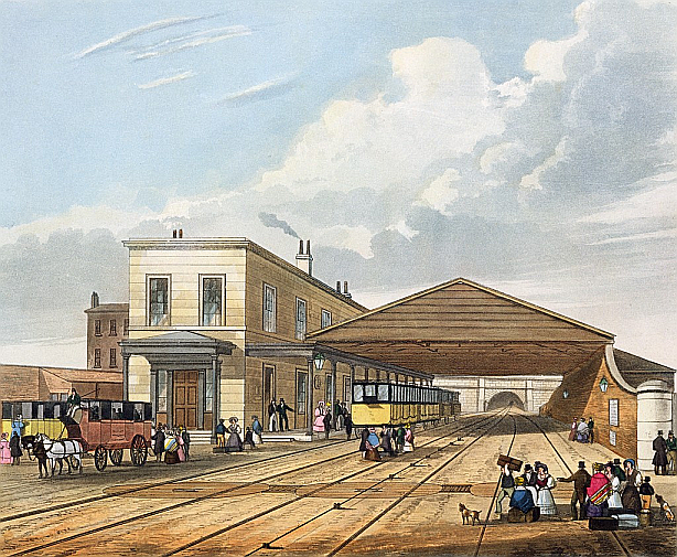
T.T. Bury's print of Liverpool Crown Street station (Wikipedia)

The story so far

Liverpool Crown Street station was the Liverpool terminus of the Liverpool & Manchester Railway which opened in 1830. Its linear design differed significantly from its counterpart at Liverpool Road in Manchester where access to the trains was at first floor level. Carroll Meeks credited Crown Street with embodying "the basic features of the modern station in embryo" and described it as the first British station (useful summary of the Stockton & Darlington's rudimentary early provision).

Little is known, however, of its origins and, in particular, of its architect. Several authors (Meeks, Hollinghurst) have suggested that it might be John Foster Jnr. Foster was certainly contracted to design the roof of the train shed (an afterthought added in 1831) as well as the nearby Moorish Arch. There is no direct evidence, however, for his involvement in the actual station building though it would not be a surprise if he added the portico. Indeed, given his prominence locally it is hard to understand why he should receive recognition for the Moorish Arch and not the station.

Other architects participated in company work, most notably Thomas Haigh who, with Franklin, designed the 1836 Edge Hill station, a replacement for Wavertree Lane. Fitzgerald believes Haigh also designed the other terminus, Manchester Liverpool Road, which was started as late as June 1830 for the opening in mid-September. He was certainly involved in the adjacent 1830 warehouse. While there are similarities between Liverpool Road and Edge Hill, they extend less convincingly to Crown Street.

Crown Street likely preceded all these developments as it provided office space during the early phases of construction of the railway. Henry Booth appears to have been located at Crown Street and progress meetings were held there on a fortnightly basis. It is possible that Joseph Locke was also based there during construction of the Wapping tunnel, a contract from which Foster withdrew.

The case for John Whiteside Casson (1767-1842)

Other local architects carried out work for the company (Cunningham and Holme, for example, at Lime Street) but here a new possibility is introduced, John Whiteside Casson. The only work definitively attributed to him appears to be the church of St Thomas Melling dating to 1835 but Pevsner tentatively credits him with Gladstone's house in Rodney Street around 1792-3 and with Sudley House built in 1824 for Nicholas Robinson, Mayor in 1828-9.

Both Hughes and Pevsner refer to Sudley as austere and, as suggested by Sharples, this may have appealed to Unitarians and Whigs such as the Holts who purchased and modified it in 1884 after Robinson's demise in 1854 (it is now a public art gallery and museum).

The same adjective might also apply to the station. From a modern (non-architect's!) perspective, however, this translates into a reasonably elegant building constructed to a budget to serve business as well as customer needs. In similar vein St Thomas Melling also has a surprising look of modernity while being designed as a low-cost Commissioners' church.

sudley house.png
South facade of Sudley House (Wikipedia)

Elements of the south facade of Sudley House appear remarkably similar to the station in Bury's print. The Holts commissioned James Rhind to make significant changes after their purchase and the verandah apparently was not in the original design but, of course, there was one running the length of the Crown Street building as well. Crown Street may well have been two-storey ashlar like Sudley and possibly more reddish than Bury's print suggests. The lack of architectural detail in the window design is unusual in high status buildings but again common to both. Sudley has a string course at first-storey floor level as did Crown Street. The roofs and chimneys are also similar.

The company likely looked elsewhere for the design of its Manchester terminus, possibly Haigh, so presumably felt the need to make a bolder aesthetic statement both there and at its second Liverpool terminus at Lime Street where Foster did the entrance facade. However, the Edge Hill "look" did not translate to smaller stations either though many of these were built somewhat later. The same might be said, of course, for the nearby Moorish Arch whose exotic appearance may have compensated for the simplicity of Casson's station at Crown Street.

Quite how Casson might have been chosen for the project is, of course, completely obscure. As we have seen, he had some connection with the Gladstones who were represented on the board of directors. Gore gives his Liverpool address as Great Newton Street which is close to the company's leading light Joseph Sandars in Pembroke Place. While the owner of Sudley, Robinson, was not associated with the railway project, his campaign for Lord Mayor was supported by director William Rathbone and, like Sandars and Booth, he was a corn merchant.

Evaluating the claim

All that can be said at present is that Casson was active in Liverpool at the right time for the station contract, he moved in the right circles and in Sudley may have built something very similar to the station. The Sudley attribution, however, is tentative and the similarity between the two buildings may simply be a coincidence. A distant possibility, for example, is that Haigh did Sudley as well as the three stations.

The fact that Casson's work for the company achieved negligible recognition could be due to his failure either to pursue or to secure further contracts. Possibly his austere style was out of keeping with the prestige Lime Street location that replaced Crown Street in 1836 and a more illustrious hand was desired, at least in Liverpool terms, namely that of Foster. However, it is also plausible that Casson sought less pressured work environments as he approached the end of his career (he was 63 in 1830 and died in 1842).

The modern world started here: Rainhill, Part 1

What, when…

I write, of course, of the Rainhill Trials that took place in October 1829, an amazing eight years before Victoria came to the throne. This was a contest (or ordeal as the organisers called it) to find the best performing locomotive and, hopefully, to demonstrate unequivocally the superiority of such engines over horses and stationary engines, a conclusion by no means obvious at the time.

If you know anything about this, you will know that the winner was Stephenson's Rocket. The prize was a £500 premium (now worth somewhere between £40K and £2.2M) on top of the purchase price of the engine assuming it passed muster. Not to mention great publicity and future sales, a place in the Science Museum and a kind of immortality tainted only by the death of Huskisson.

…and where?

Well, I knew it was in Rainhill so I went there (by train from Liverpool, of course) and visited the little museum at the back of the Library. It's in a railway carriage (naturally).

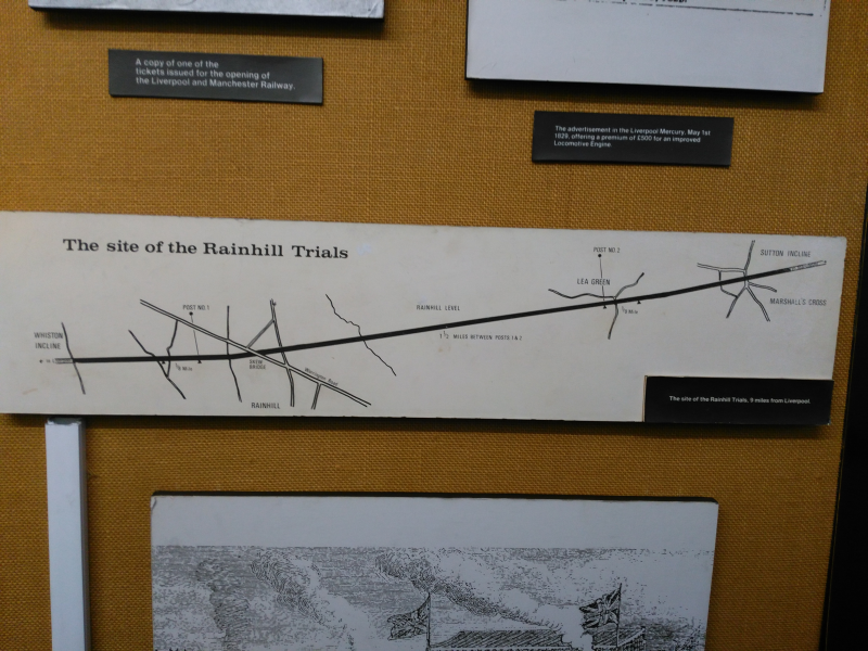
And there's a map.

Rainhill course mapr.png

Which led to a narrow bridge over the Liverpool to Manchester railway, sadly not the original wooden bridge but probably at a fairly similar location.

Rainhill footbridger.png

And pointing the lens on my phone through the wire grille looking west, I saw this. Humour me and try to imagine Rocket being readied for its ordeal and then pushed by hand to the starting-post.

Rainhill looking westr.png

Now look east towards Manchester and imagine Rocket accelerating away towards Post 1 where the judge, Mr Rastrick, starts timing the run.

Rainhill looking eastr.png

I guess everyone interested in the Liverpool & Manchester Railway makes this journey knowingly or otherwise in passing on the line beneath. Needless to say, the rest is history or, in this case, the long read that follows in Part 2.

Early stations: Reid's Farm, Chat Moss (Part 2)

The Liverpool & Manchester Railway (L&MR) opened in 1830 and Reid's Farm was an early stopping-place, first appearing in fare schedules in 1831. The first part of this post looked at how Reid's Farm got and lost its name, subsequently becoming known as Barton Moss (which I take to be a subset of Chat Moss in the context of this post).

Here I conjecture as to its visual appearance but first address the question of the number of stopping-places on the Moss. As ever, much is drawn from Thomas (1980).

chat<u>moss</u>map3.png

How many stopping-places on Chat Moss in 1831?

The 1831 fares schedule lists just two, Bury Lane to the west and the subject of this post, Reid's Farm (also known as Barton Moss 1), to the east. Both were close to roads running perpendicular to the railway and also to the extremities of the moss. I have yet to identify a map of the area prior to 1845 by which time the landscape may have changed significantly. However, in the case of Bury Lane it seems the railway was carried over the road by a bridge but at Reid's Farm there is no continuation of the unnamed farm track leading off Fiddlers Lane.

The railway appears to have sliced through the northern tip of the land let to Edward Baines and managed by Reed so access to the residual fields north of the line would have been required. There was a narrow gauge railway running on the approach road to the south. It was used to ferry manure up the track from the River Irwell so some kind of crossing might be expected and hence perhaps the need for staff and the evolution of a stopping-place.

According to Thomas, a contract was signed with the L&MR by "Chat Moss Farm" in April 1832 to supply manure by rail at 1s 6d (7.5p) per ton. However, this presumably did not involve Reed's Barton Moss Farm or he would have mentioned it to the parliamentary committee in 1833.

Thomas also states that the L&MR had six buildings of wood or stone (not brick?) on the Moss as early as 1830, plus a smithy. Some of these were presumably for gatekeepers who likely fulfilled some of the function of the early policemen. On opening there were approximately 60 policemen along the length of the L&MR. This suggests one every half-mile although it is likely that they were more densely clustered in busy areas around junctions. By 1832 there were 52 but that number was cut by 20 in what was a bad year for passenger numbers, probably due to the major outbreak of cholera.

The 1840s map suggests additional crossings at Astley and Lamb's Cottage, both of which subsequently became stations for a time, so that suggests possibly four men on the Moss able to stop trains on request. Another station, Flow Moss, east of Bury Lane, opened sometime between 1832 and 1838 (at the request of farmers so perhaps this was the station also called McGrath's Farm) but was not on a crossing and hence presumably unmanned prior to becoming an official station.

Perhaps specifying just two locations in the 1831 fares schedule was an attempt to limit the number of potential stopping places and hence minimise operating delays. The notion that there were just two stopping-places on Chat Moss in 1831 helps in the interpretation of the visual record from that year.

Early pictures of the railway on Chat Moss

There are two famous pictures of early company buildings on Chat Moss, one by Thomas Talbot Bury, the other by Isaac Shaw.

Bury's view

chat<u>moss</u>Bury_print.png

Bury's elevated perspective (1833 revision, Wikimedia) shows tracks on the causeway stretching into the distance. The shadows suggest we are looking west towards Liverpool. There is probably a degree of artistic licence as the two trains appear to be on the wrong tracks. Buildings are evident in the distance (perhaps at Newton, Golborne and Leigh) and a man, probably a policeman, is seen walking towards the nearest train.

The carriages suggest this is a first class "glass" train which would not normally stop for passengers other than at Newton. Interestingly, it is pulling a low wagon of some kind, possibly with additional luggage covered by a tarpaulin.

To the right of the track is a small cottage. The company bought a substantial swathe of land beside the track, 50 yards wide in places, to facilitate drainage. Hence, it is probable that it is a company building. Indeed, many early prints show similar box-like structures adjacent to the track.

There was a vogue for such cottages in the 1830s as evidenced by their inclusion in a popular encyclopedia of architecture by Loudon. Although the Barton building looks fairly rudimentary, such buildings were often used as entrance lodges to country estates or toll booths, both appropriate models for the proto-station. As Loudon's book makes clear, they were typically brick-built with two main rooms, both heated, and might be expected to house one member of staff and possibly his wife. This example, however, appears to be smaller than most with no windows next to the door. There is also a small bunker, perhaps for storing coal or tools.

The original gatemen (and in the absence of gates I'm envisaging some overlap with the duties of policemen) were recruited from labourers formerly engaged in building the line so it's likely that low-level track maintenance was also part of their remit. The presence of what appear to be mounds of sand and gravel next to the building are consistent with such a role, possibly also serving as a depot for maintenance teams. Integrity of the track would have been a major concern in the early days, doubly so on the Moss as it drained and settled.

Is this a station/stopping-place? If a location had staff then this is a possibility notwithstanding the apparent absence of formal crossing gates. Indeed, Barton Moss station does not appear to be a conventional crossing according to the 1840s map. More positive evidence, however, comes in the form of the flag post used to signal trains to stop although its location seems a little odd unless the trains are, as suggested previously, on the wrong tracks. As expected for this non-stopping train, no flag is flying.

Is this location near Barton Moss? The fine patchwork of channels is consistent with Reed's drainage method where ditches were at first as little as 6 yards apart.

We also see the railway embankment merging with a possible causeway beyond. This is consistent with Stephenson's initial approach, tipping spoil to create the Barton embankment as the permanent way edged out from the Manchester side of Barton Moss. However, the 1840s Ordnance Survey map suggests that the embankment (if such it is) diminished before Barton Moss station, not after as we see here. This may be a matter of degree or again artistic licence on the part of Bury. The green area seen entering on the right could be Worsley Moss.

By process of elimination (there is no evidence of a bridge as at Bury Lane), it seems likely that this print shows Barton Moss station. The major discrepancy is the absence of Barton Moss Farm to the left/south, possibly for aesthetic reasons, although there are suggestions of a road or track. The building we see here may have been some distance from the farm road itself, of the order of 75 m. There are, indeed, small buildings shown on the 1840s map at this location.

OpenSim build of Bury's view

chat<u>moss</u>Bury.png

The build has a number of limitations. It does not attempt to mimic the drainage pattern seen in Bury's print and rails ran on wooden sleepers here though I suspect these were buried like their stone equivalents. The permanent way is probably also a little narrow.

The build does show, however, that Bury's elevated perspective satisfactorily excludes both the hut which is 150+ m further up and the putative farm buildings (shown in red) that appear in Shaw's sketch.

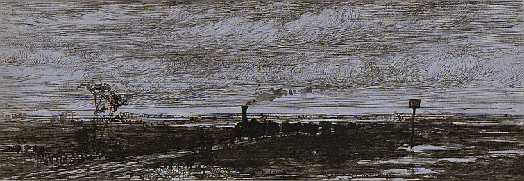
Shaw's view

chat<u>moss</u>Shaw_sketch.png

This view is commonly seen in engravings and Thomas locates it as "near Lamb's cottage". This sketch (courtesy of the Yale Center for British Art) gives better contrast,

It is also easier to assign a station as Shaw helpfully includes a milepost signifying 24 miles from Liverpool. The first Barton Moss station was 23.65 miles from Liverpool suggesting that this location is a little east of the recorded location assuming a constant starting-point at Wapping for the measurements. If this is a stopping place then it is almost certainly Barton Moss/Reid's Farm but on the opposite/northern side of the track to the station shown on the map and the cottage on Bury's print.

In this image we are again looking west but this time the trains are on the correct track. While there is no flagpole, we can see someone, perhaps a policeman, signalling the (presumably second class) Manchester-bound train to stop for the two passengers shown chatting.

They are standing next to a very spartan, albeit heated, hut. According to Thomas, one of the directors, James Cropper, was an advocate of wooden structures which were both inexpensive and, as demonstrated subsequently, readily portable. Whether the structure shown here was solely for use as a waiting-room is a moot point. The two visible sides of the hut are notably devoid of windows apart from what may be a small porthole.

The 1840s map shows a larger building at the milestone which seems to have a garden. There is also a larger building at the station now located at the top of the road.

Like Bury, Shaw also highlights the maintenance role with tools and assorted heaps of ballast. Close examination shows a lamp suggesting that the hut was manned after dark.

Behind the hut we see a probable drainage channel and a trace of buildings on the horizon (Leigh?) although they could be trees. The drainage channel, if such it is, poses something of a puzzle in terms of its height relative to the bog on either side.

To the left (south) is Barton Moss but the ground-level perspective makes it harder to see the smaller channels, many of which would be covered anyway. The tall building in the distance might be part of Barton Moss Farm, notably missing from Bury's view. In later years the farm moved south and was then replaced by two others, Manor and Birch Farm, of which only the former continues.

To the left is a group of labourers who seem to be working on the drainage channels. A closeup shows that one seems to have a cylinder of some kind in his hand, possibly a bottomless cask, which may be used in making the drain. Another has a ladder-like structure which might be additional support for the walls or base of the channel. Alternatively it may be an implement involved in cutting the drain.

A more distant possibility is that they are building the railway cottage seen in Bury's view.

OpenSim build of Shaw's view

chat<u>moss</u>Shaw.png

The build attempts to reconcile the two views. My first thought was that the cottage (and flagpole) to the south of the tracks might simply be further along and obscured by the Liverpool-bound train on the left. However, while this could be arranged by judicious positioning of the train, the perspective makes this quite difficult to achieve.

Moreover, the 1840s map suggests that the buildings of Barton Moss Farm were some 250+ m from the track (shown here in blue), much farther away than those shown in red in the Shaw sketch. Their outline is also a dubious match for the buildings shown on the map. Various explanations are more or less plausible, e.g. that these are either additional station or farm buildings. Perhaps the farm buildings were removed pre-1840s because of the noise from the nearby railway.

Finally, we have to allow for artistic licence. Perhaps both artists chose to accentuate the famously desolate nature of the scene by showing only a limited number of buildings. The presence of two trains is common to many depictions but was probably an unusual sight except at Newton, midway between Liverpool and Manchester. Their inclusion was perhaps intended to show how train travel could conquer such wastes and, indeed, make them productive. In the present day, however, the pendulum seems to have swung back in favour of conserving what little remains of the original bogs and their associated wildlife.

The evolution of an early station

chat<u>moss</u>NE.png

If the two pictures do indeed show the same stopping-place, they suggest that Barton Moss "station" started somewhat arbitrarily at the milestone located between two roads leading up to the railway that presumably furnished the majority of its passengers. The hostile nature of the environment required early construction of a cottage which, given its size and location, was probably not used as a waiting room. Instead, a wooden hut was provided for the purpose somewhat akin to the situation at Ordsall Lane. The role of the larger building seen in Shaw's sketch (and in red on the OpenSim view above) is unknown though its distance from the railway suggests a farm building perhaps predating arrival of the permanent way. By 1845 Barton Moss Farm was located some 250 m from the railway (shown in blue). Additional station buildings were present by this time.

The station shifted west to Lamb's Cottage in late 1832. The reason is unclear but there seems to have been a degree of restructuring due to a major cholera outbreak, the first in the UK, and reduced passenger traffic. The 1840s map suggests that the cottage at Lamb's Cottage may have been larger than the one at Barton Moss and perhaps it was cheaper to relocate staff there rather than build something better at the original location.

On the return of the station to Barton Moss in 1839 a larger cottage appears just next to the site of the former hut as well as a sizeable station building close to the top of the road. The old cottage likely remains until the station closes, perhaps for use by platelayers.

The last step in the evolution of the station occurs in 1862 when the it moves to the top of nearby Barton Moss Road (Barton Moss 2). The old station then disappears apart from the new cottage which persists at least until 1949 and presumably continues to house railway employees.

Barton Moss 2 closed in 1929. The Disused Stations website has the details (also for Barton Moss 1) but follow this link for a better picture of Barton Moss 2 on Flickr.
Early stations: Reid's Farm, Chat Moss (Part 1)

Barton Moss map.png

As ever, there is a fair degree of conjecture in what follows. Basic background comes from standard texts by Thomas and Ferneyhough.

The evolution of intermediate stations

When it opened in September 1830, there was no timetable for intermediate stopping places on the Liverpool & Manchester Railway (L&MR), indeed no list of such stations at all. That's not to say that journeys to and from intermediate stops didn't occur even on suppposedly non-stop first class trains, just that it was a largely informal, smallscale affair with "road money" being collected by the guard. Thomas estimates that there were about 25 potential stopping-places defined largely by the stationing of an L&MR employee at a fixed location and, of course, a passenger.

In 1831 when the first schedule of fares from intermediate stations was published, no times were specified for arrival at these locations. The reason given was that trains stopped only on request at staffed locations and typically at only around six per journey of the seventeen that had actually made their way into the schedule. Factoring in additional unnecessary stops would slow down operation of the railway for both the stopping trains (mostly second class carriages) and the first class trains that stopped for passengers only at Newton.

These intermediate stations were mostly level crossings where the gatekeeper would stop the train when requested by raising a blue flag on a pole (passengers requested a stop via the guard). Although gates were generally present (stations often had the word Gate in their name), in quiet areas these were typically closed against road traffic by default. Gatekeepers were also involved in maintaining the track, the first cohort being recruited from labourers who had built the railway.

Once on board, passengers paid their fare to the guard who apparently made his way between carriages while trains were underway. The guard also checked that passengers did not travel beyond their declared destination although the company did not make a fuss over what they considered a sideline to their main business of moving freight and passengers between the two termini.

The remainder of this post attempts to answer three questions: why was a stopping-place on Chat Moss called Reid's Farm, who was Reid and what impact did the railway have on him?

Chat Moss Wynne.png
Sketch by Francis Elizabeth Wynne (c) Llyfrgell Genedlaethol Cymru – The National Library of Wales

Reid's Farm:

Among the early stations Reid's Farm stands out as particularly transient, appearing just once in the fares schedule in 1831, for some reason lumped in terms of fare with Patricroft for Manchester-bound trains and with Bury Lane for trains from Liverpool. By 1832 it had disappeared.

The locations of early stations on Chat Moss changed frequently before ultimately disappearing completely from this thinly populated area. At the time Chat Moss encompassed a number of very boggy areas with the easternmost being Barton Moss. Indeed, it has been suggested that Reid's Farm became Barton Moss station although this itself closed, reopened and shifted location eastwards before finally closing again.

The water-logged mosses made the area desolate and impenetrable to all but the most hardy and determined. Indeed, it was widely believed that it would prove an insuperable barrier to the passage of the railway between the Liverpool and Manchester. Embankments edged out from either extreme of the four and three-quarter mile stretch but spoil tipping was insufficient to bridge the most water-logged areas. Ultimately George Stephenson followed the advice of Robert Stannard and adopted a strategy of draining the relevant area and then floating the railway on a mesh of saplings, dried moss, sand and gravel.

Stannard had been the first to establish a horse-drawn light railway on the Moss as part of an attempt by Liverpool polymath William Roscoe to bring the area under cultivation some 25 years previously. The bankruptcy of the bank Roscoe managed brought an ignominious end to his largely unsuccessful experiment, Roscoe hiding on the Moss from his creditors until his financial affairs were put in order. Others, however, continued the quest, notably Leeds MP Edward Baines who acquired much of the land that Roscoe had started to bring under cultivation.

Who was William Reed?

Baines employed a land agent to manage this enterprise, one William Reed. Reed's strategy for draining and fertilising the area of Barton Moss was notably successful to the extent that he was consulted on similar projects elsewhere and in 1833 had the distinction of being appointed secretary to the Manchester Agricultural Association.

Reed apparently lived on Barton Moss Farm but probably had only a minor share in it. His role was more advisory and managerial and it is likely that whatever farming he did personally ceased around 1832. The farm itself was owned by a consortium of subsidiary investors in the Baines project, many from Liverpool (with possible overlap with railway investors). It was close to the railway and near the end of a lane with its own light railway used to carry first marl and later nightsoil (sewage) to the fields from Manchester whence it came by barge.

As Barton Moss Farm was adjacent to the first Barton Moss station, it seems not unlikely that the latter's original name, Reid's Farm, derives somewhat obliquely from the farm's occupant, William Reed. This appears to have caused Reed some embarrassment as he wrote to the Manchester Guardian newspaper in November 1831 pointing out his very tenuous claim to the farm. This public repudiation might explain the rapid change of station name to Barton Moss.

Barton Moss was abandoned in favour of Lamb's Cottage in 1832 but was back in the timetable by 1839 although it subsequently moved eastwards to its second position in 1862. The L&MR named at least one other station on Chat Moss after a local farmer, in this case McGrath's Farm which replaced Lamb's Cottage according to Thomas but appears otherwise largely forgotten.

Reed, the land agent

What little we know of Reed comes from occasional mentions in the newspaper and testimony he gave to parliamentary select committees, both indicators of esteem. We learn, for example, that Reed had previously worked in Surrey and that initially he was at best lukewarm about trains crossing the Moss. When questioned by a Parliamentary committee in 1833 he said that there was little use of the railway for taking produce to market and that the railway's transporting of Irish agricultural goods to Manchester lowered the profitability of farms on Chat Moss. As these farms had given jobs to poverty-stricken hand-weavers who had already lost one livelihood due to mechanization, this development potentially had severe consequences.

Reed changes track

What subsequently became of Reed is subject to a good deal of supposition, his name being a common one. One possible interpretation, hopefully an interesting one, follows.

A land agent called William Reed then gives evidence on the performance of trains on the Liverpool & Manchester Railway in 1833 in hearings for the Southampton Railway bill. His firsthand expertise is gained in the presence of the resident engineer. It looks like the agriculturalist has changed track.

By 1834 Reed was giving further positive evidence of benefits accruing from the railway to a Parliamentary Committee dealing with the Great Western Railway.

In Manchester his trail then goes cold. Perhaps the work on Chat Moss was now largely done and greater challenges lay elsewhere. Baines pointedly fails to name him in his history of Lancashire and gives credit for Chat Moss to his predecessor instead.

Reed the railway entrepreneur

In 1835 William Reed's name appears on a draft land conveyance on behalf of the Liverpool & Southampton Railway Company (L&SR; later the London & South Western). He is listed on the document as secretary of the company and is living in Vauxhall, Surrey. The company was incorporated in 1834.

A William Reed becomes a member of the Institution of Civil Engineers in 1840.

The William Reed from the L&SR then moves to France to act variously as secretary or director of the largely British-built Paris-Rouen, Rouen-Havre and Paris-Strasbourg Railways in France. During this time he probably lived in Paris in Rue de Berlin. Liverpool financiers such as John Moss and Charles Lawrence figure as directors of some of these enterprises and it is possible that the connection goes back to the Chat Moss days. These and others such as Chaplin, Locke and Brassey also featured in the L&SR.

Reed features prominently in the diaries of railway contractor William Mackenzie between 1841 and 1849 alongside railway luminaries such as Locke and Brassey during construction of the railways in France. Latterly Mackenzie refers to him as "Old Reed", possibly to distinguish him from "Ch Reed" who is also mentioned. MacKenzie died in 1851 at the age of 57 and is buried in the churchyard of St Andrew's Church, Rodney Street, Liverpool.

Rouen<u>and</u>Le<u>Havre</u>Railway.png
Opening of the Rouen-Havre railway in 1844

The year 1845 saw a peak in railway projects and in 1848 a William Reed is listed as being or having recently been a director of the Dutch Rhenish Railway Company and the Royston & Hitchin Railway Company. Bradshaw's Register of 1862 lists him under both the Severn Valley and the Wimbledon & Croydon. However, a street directory of Kensington states that he is employed by the seaman's wages branch of the Admiralty. Perhaps this is a consequence of the railway bubble bursting but it might also mistakenly refer to his son of the same name.

Reed, beyond railways

Apart from his business affairs, little is known of Reed other than his having spent time in Surrey before his move north. The Reeds were a prominent county family but his origins are obscure. During his tenure at the London & South-Western he lived adjacent to the line at Weybridge in what may have been a company-owned mansion called Fir Grove that was subsequently purchased by his chairman John Easthope MP.

He had at least two daughters, Mary (possibly also known as Polly) and Rosa, and four or more sons, including William Thomas Reed (first son) and Charles Edward Reed (fourth son) and it is the latter who appears alongside William on the list of directors and staff of several projected railway companies.

A limited family history search has been carried out using the free census database FreeCEN. This suggests that in 1851 Reed's wife Elizabeth Bishop, aged 59, was living on the south coast at Hove along with her two daughters Mary and Rosa and two of her sons, Charles Edward and Frederick. Of these the eldest was Charles Edward ("occupation: gentleman") who was 25 and had been born in Streatham, Surrey. His sister Mary was 22 and listed as born in London, Middlesex. The two youngest, Rosa (18) and Frederick (16), on the other hand were both born in Salford, Lancashire. This suggests that Elizabeth was resident in Lancashire between 1833-1835 although her husband had started work in the south towards the end of that period.

The house, 39 Lansdowne Place, was part of a well-appointed terrace adjoining the sea front and the family had a butler, cook and housemaid. The location would have been convenient for visits by the children to their father in France. Indeed, William Mackenzie's diary mentions that he dined occasionally with Elizabeth and the two daughters as well as William ("old Reed") and Charles Edward. Reed is also sometimes accompanied by a Miss Harcourt who is probably his niece. His sister may have married a Harcourt, a 66-year old James Harcourt being listed in an 1861 census return for Thomas (Thos.) William Reed. At this time Thomas, born in London, was 42 and resident in Beech Lodge, Isleworth, with his wife Maria. Harcourt was a half-pay officer born "W Indies Calcutta" raising the possibility that William or Elizabeth might also have had overseas military connections.

Reed's connection with the projected Severn Valley Railway dates back at least as far as 1857 when he is listed as deputy chairman with Charles as secretary and Sir Samuel Morton Peto as chairman. Around this time Reed was living in Hanworth, Middlesex, but seems to have moved to Kensington where he owned and let a number of properties, finally selling his own house in 1862. He is described as a "man of substance". His son Thomas William Reed describes himself as a "proprietor of houses" in his 1861 census return so may have taken on this role from his father or alternatively father and son may have become conflated.

William Reed may then have maintained a London residence, Winter Lodge (and/or Oak Lodge), on Addison Road, Kensington and a country house at The Mount, Sunninghill.

More than one Reed?

Reed died on October 15th, 1865. The notice in the Gazette(pdf) ties together his residences in Sunninghill, Kensington and Hanworth, all of which are cited in railway company lists at one time or another.

If there is an obvious weak link in the narrative, it is in the transition from Chat Moss to London. It seems not unlikely, however, that he impressed the Liverpool men with hsi competence and had a skill set that was of value to them. Mackenzie's participation in the Paris-Strasbourg project was, he said, conditional on Reid acting as British co-director. Nobody else would do.

Election Day sketch notes

A day I'll long remember so hope you'll forgive mini-blog.

Marginal seat, fifth in Tory hit-list. Concerned citizen, seeing (mostly) dire opinion polls, walked off street in Hoylake night before. Solo leaflet drop in pouring rain, sodden address list falling apart, Tory team doing similar nearby. Slow progress in gathering gloom, disoriented, drenched, done by 10, home, sleep.

Up at 4:30, leaflet drop in occasional showers at 6, only earlybirds in centre as many doing drops elsewhere in region. Then telling at polling station for first time, learning ropes, then back to centre with returns. Car park near full, centre amazingly transformed into bustling hive of activity. Folk from all over, just as diverse as JC's speech on WK beach. Atmosphere friendly but determined. Organised chaos to be expected, probably many people like me new to it, others coming across for day.

Home to vote, quick snooze then back to centre for more. Missed pies though saw remains! Back out to polling stations, swapping between them for 1-2 hr shifts, sustained by coffee, biscuits and sarnies at centre. Met wonderful Labour tellers, young and old, but young in particular, many from safe seats, were real credit -- groundwork canvassing in weeks before, worked til they dropped on polling day. Impressed not only by motivation but by depth of political savvy too. Volunteers still coming in after work, some with kids in tow, wanting to help.

Voters in solid Labour area also inspiring. Ordinary folk, going to or from work, mums with kids, first-timers with parents, parents with proxies, frail and disabled determined to vote in person.

Finished at 7. Too knackered for knocking, lots of tired folk in centre, major credit to teams still on streets or heading that way to bitter end. Farewell to equally exhausted Andy who organised tellers, his fingers crossed we'd done enough.

Home, meal, online. Disbelief at surprisingly positive exit poll, early results not overly helpful. Too tired to fret much. Sleep.

Rest is history of a sort because we're not done yet. Til next time. :)

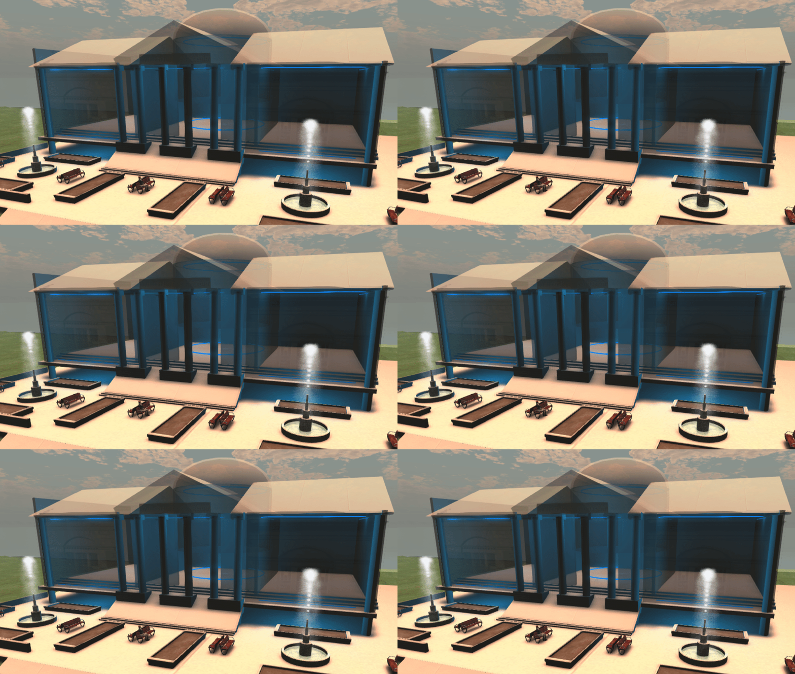
Concept for a William Roscoe Museum

These notes capture some ideas for the concept for a William Roscoe Museum in the presently empty Lyceum building at the bottom of Bold Street in central Liverpool. It is a very early work-in-progress.

Overview

The building comprises three spaces. If you look at it from Bold Street, from left to right:

  • Museum of the Past, telling the story of the growth of Liverpool during Roscoe's lifetime in terms of his own life experiences and his involvement in the arts, sciences, agriculture, humanities (history, poetry), politics, commerce, etc, as well as his roles in establishing new institutions in the city and acting as a cultural ambassador for visitors from other countries. Physical exhibits would be augmented by interpreters in period dress as well as augmented reality (AR) displays customised for different ages and backgrounds and delivered by selecting virtual books from tables or shelves.
  • Cultural hub: this would be a hub pointing to other cultural institutions across the city region as well as providing a small performance and interpretation space. By default it would show an AR performance of Roscoe's poem for children "The Butterfly's Ball, and the Grasshopper's Feast", perhaps based around a physical sculpture.
  • Museum of the Future and a showcase for science outreach and innovation in industry and commerce.

The proposal would in any case make an interesting OpenSim build.

vMuseum_original.gif

Whatever happened to Liverpool Crown Street station?

The short version recounted in most books is that in 1836 Liverpool Crown Street station became a coal yard once it no longer served passengers. The longer version is a little more involved. As ever, there is a fair amount of surmise and interpretation in what follows.

As early as 1831 it looked as though Crown Street's days were numbered. Not only was the station too small and well outside the city centre but letters were being published by the Liverpool Mercury newspaper complaining of the "sea of mud and filth" it generated. This presumably derived from the increase in horse-drawn traffic in the vicinity, the omnibus service, carters and hackney cabs, as well as movement of cattle, pigs and sheep from the docks.

Of course, it was not simply the operation of the passenger service as there were two areas of similar size next to the station, namely the goods yard (normally called Millfield Station) and the workshops for erecting and maintaining wagons and carriages (often called Gray's Yard). Both would generate their own traffic and, of course, Crown Street traffic would itself switch to carrying freight rather than passengers. It seems unlikely that the "sea of mud and filth" abated.

Nevertheless, by 1831 the company had decided to move its passenger operations to the present-day Edge Hill station with a tunnel down to the centre of Liverpool terminating in a grand new station on the site of the former Lime Street cattle market. This immensely ambitious project was successfully completed and the new stations opened in 1836.

But what happened to Crown Street?

Readily available information is scarce but we can make some guesses based on maps and a report from the Liverpool & North-Western Railway Company (L&NWR) dated 1849 (following a series of amalgamations, the L&NWR now ran Crown Street). The report identifies a number of specific actions that could be taken to promote coal traffic into and exports from Liverpool. Among the recommendations was to clear the old cattle station so that track could be run directly into the coal yards north of the former station.

Crown St map.png

The coal yards

Although Millfield carried a significant volume of coal, the major proprietors were to have their own yards to the north. These included pit owners such as William Hulton of Hulton and Richard Evans of Haydock. Movement of wagons in that direction took a somewhat circuitous route, presumably as they needed to use the cable system driven by the engines in the Moorish Arch. The train (minus locomotive) was drawn up into the station through the 1829 Stephenson tunnel and wagons were then shifted individually via turnplates onto a branch heading to the yards to the north. Presumably much of the motive power was provided by horses. Although the company only had two for its own use by 1849, the maps show many of the coal proprietors had significant stabling in their yard.

The cattle station

By 1836, however, there was also a need to herd cattle from Ireland onto purpose-designed wagons for shipment to Manchester. Given that the 1849 report stated this cattle station had to be removed to revise the track layout, the most likely location was the site of the former Railway Offices.

Two additional sidings and a set of four turnplates were installed so that trucks could be shifted from the cable-driven middle track emanating from the Stephenson tunnel to the new sidings. The site of the former station building was occupied by a series of seven loading pens.

My guess would be that cattle were driven up the hill from the docks and entered through the gate by the entrance block. There was probably a wall there to keep the animals off the track. The cattle then crossed the new track extension going into the northern coal yards. It would be feasible to block these routes with wagons as there were adjacent turnplates. The cattle could then enter a collecting area (sheds or stables there originally had been removed) before being fed into the loading pens adjacent to the track. One constraint appears to have been the location of points midway along this siding such that only three wagons could be sent towards the tunnel at a time.

There was also a further set of pens at the end of the two tracks, possibly holding pens for large or mixed loads or, alternatively, used for end-loading onto wagons on the second parallel siding. Another possibility is that the two railway companies with a presence at Crown Street, the Liverpool & Manchester and Grand Junction, had separate but colocated facilities.

The question as to whether the shell of the old station building was used for some of the loading pens is moot although there is a good match for the location of the station and the rear walls of the pens. In any case, reuse of materials from the former station would seem logical.

Coal

Construction of the coal yards to the north likely required some excavation and they did not become operable until the respective collieries (Hulton and Haydock) were themselves connected to the main L&MR line from Manchester in 1831. Coal proprietors also used Millfield although the process was equally laborious until the second tunnel was opened (and which ran into Millfield) in 1849. Unlike the Stephenson tunnel, this could be worked by locomotives.

As mentioned previously, the wagons were laboriously turned one at a time onto the northern extension even after the second tunnel was opened in 1846. The cattle station was basically blocking a more direct route to the northern yards.

In 1849 the L&NWR northern Goods Manager Braithwaite Poole compiled a report recommending an increased emphasis on coal. The manner in which this was enacted is unclear but the end-result was movement of agricultural traffic to the extreme north of the yard, demolition of the cattle station and formation of an extension that curved from the new tunnel through the site of the cattle station and down the centre of the northern yards to the new agricultural depot. Millfield was to be given over exclusively to coal and the now-redundant buildings in Gray's Yard demolished.

Poole was subsequently and arguably somewhat harshly dismissed by the L&NWR. His plans, however, enabled Crown Street to continue to operate successfully until space became an issue and further expansion then took place at the new Edge Hill station. Crown Street itself closed in 1972 and is now a public park.

[1/5/17: map added and some minor updates][16/5/17: added comment re shared use of cattle station]

Look behind you! The Crown Street entrance block

Crown Street was the first station on the Liverpool & Manchester Railway which opened in 1830. First- and second-class passengers were initially conveyed by distinct trains with yellow and blue carriages respectively. Second-class travel was less expensive and accordingly more spartan.

The conventional view of Crown Street station shows the Railway Office with the 1829 Stephenson tunnel in the distance (The Trust has a very nice compilation). The Railway Office appears to have been demolished when passenger operations switched to Lime Street in 1836. Of course, there were other buildings on the site and one that is rarely mentioned is what I call the Crown Street entrance block. This would have been to the left rear of the conventional view and beyond Crown Street would have been the walls of the Botanical Garden.

The entrance block

This comprised two buildings and a curved wall (which I will call a quadrant) abutting a wall running from Smithdown Lane to Crown Street. There was a similar quadrant facing it that was joined to sheds, possibly stables, running behind the station. Some maps show a rectangular structure within the quadrant with a narrow rectangle leading to the adjacent building. I'm assuming that this was a horse trough and associated pipe that the quadrant wall protected from collision with coaches. The pillar seen in one picture would likewise serve as a bollard for the portico to the main office building, particularly if the coach on that side was required to reverse into the space. The presence of horses would inevitably lead to the possibility of the clothes of passengers being sullied if forced to cross the yard; reversing in would help avoid this, another perk for premium service.

Firestorm-bin<u>2017-04-30</u>09-30-22.jpg

As far as the entrance block is concerned, I am suggesting that the innermost building provided quarters for the gatekeeper while the streetside building was a slightly grander affair. One possibility is that this served as the coaching office for second-class passengers as well as the reception for parcels. Clearly it was in a good position to control access to the yard and it also provides the means to partition the first- and second-class passengers who were catered for in Manchester by two different entrances. The end-on orientation of the Liverpool building otherwise makes this awkward.

Firestorm-bin<u>2017-04-30</u>09-56-12.jpg

Did the streetside building become a coal office?

The building as shown is loosely based on plans for one of the coal offices on Crown Street. Thus there is a front door which leads to a counter. I would suggest that there was a long desk under the front windows and a coal fire to the rear beyond which parcels might have been stored. The upper storey served as overnight accommodation for train crew.

The build is also influenced by a 1972-dated photograph on p.13 of Hugh Hollinghurst's recent book on Liverpool's Railways Through Time. This shows the two buildings of the entrance block although the gatekeeper's hut is longer than shown on the early maps (some elongation was evident on maps by the 1950s). While the original block may have been demolished and rebuilt, I am intrigued by the possibility that the original second-class railway office may have been repurposed as a coal merchant's office and known as such to residents of the nearby Myrtle Gardens well into the twentieth century.

The Liverpool Botanical Garden, Part 2: a virtual visit

Some major caveats: this post features a very early build of the garden which follows an outline published map. Please bear in mind that it is based on limited research and negligible botanical knowledge! In particular, I have been unable thus far to find any pictures of the Stove or information on the role(s) of the two thin rectangular blocks on either side (I have supposed they are related to the heating system and thus have given them rather ugly chimneys). Even where images of a building have been found, they invariably show only one side and are only available uncoloured. Rather crucially, few plants have been added thus far and there is no internal detail within the buildings. Even so, I hope the model will grow over time and serve to complement the adjacent Crown Street railway station build. I find the juxtaposition of the garden and station very interesting in a symbolic sense and the two now occupy the same 768x768 metre OpenSimulator varregion.

A visit to the botanical garden

It's springtime in Liverpool 1830, a sunny day for once and the ideal place to be is the Botanical Garden on Crown Street. Assuming you can afford it, of course. It's maintained by subscription with limited entry so not really what you would call a People's Park.

In the distance we can see the new station underway. It will be opening in the Autumn and the adjacent works is busy making carriages and wagons. The foundry belches out a fair bit of smoke and there's some concern for the plants although to be fair there are plenty of chimneys in evidence in the garden -- they're part of the heating system needed to keep the exotic plants warm on less clement days.

The garden has rather a strange layout, basically an elongated triangle. It's surrounded by a high wall which helps shelter the plants but also, of course, restricts entry to those who can pass through the gate.

The entrance

crown street and gate.jpg

The gate featured in Mr Troughton's illustrations to Mr Corry's book on the History of Liverpool; indeed, there were two prints of the entrance gate that are dedicated to Dr Bostock, one of the two physicians who supported the initial project along with Mr Roscoe. The garden plays an important role in the cultivation and study of plants for medicinal purposes. The pictures in the book show two different versions of the gateway itself but in one case also the house adjacent to the two lodges.

The curator's house

This is where Mr Shepherd lives. He is the curator with overall responsibility for maintenance of the wide range of plants in the collection. Like Mr Roscoe, he is now advanced in years and supported in his work by his nephew Henry as well as the staff he oversees.

The herbarium and library

Mr Shepherd's house is also the location of the herbarium, a very valuable record comprising dried and pressed specimens of many thousands of plants from all around the world. Liverpool is fortunate in being a port. Many sea captains return from voyages with novel plants that they pass onto the botanical garden. The garden also employs professional plant hunters who explore other continents with the aim of finding new plants for the garden.

Making sense of this diversity has led to development of a new science, botany, and botanic gardens in places like Chelsea, Oxford, Dublin and Edinburgh have provided specimens for scientific study as well as underpinning the medical and economic applications of plants. Mr Shepherd's house also holds a library of valuable books that assist in the identification of plants. Mr Roscoe has been engaged in writing a monograph on the tropical Scitamineae which include commercially significant plants such as ginger, arrowroot and turmeric.

The initial view on entry

view through gateway.png

Entering through the narrow gateway one is immediately struck by how the garden fills the field of view. Immediately you can see a gently winding path that follows the righthand wall and extends into the far distance. It is complemented by a straight path that follows the course of the lefthand wall. The view is, however, intercepted by two buildings, the Stove and the Conservatory.

The paths in this area are generally circular and this shape provides visual interest as well as delineating particular habitats and giving maximum opportunity to observe the plants therein.

The Stove

The stove is the repository of the most demanding tropical plants. As its name suggests, it is heated by one or more stoves. Besides rare and delicate plants, it is also home to an iguana. Those accompanied by a dog are advised not to take it into the Stove as the iguana is readily startled by their appearance and likely to attack the canine with its tail before running off to hide.

Beyond the stove is an area for the growth of plants found in rocky situations and beyond that an area for plants adapted to boggy conditions.

2017-04-14_21-53-02.jpg

The Conservatory

Conservatory.png

This also features in Mr Troughton's illustrations and the picture in this case is dedicated to Mr Roscoe. The building is seen to its best advantage on the return as there is a large glazed area facing roughly to the south. The chimneys signify that it is a well-heated building as required by its principal dimensions of some 240 feet wide by 24 feet high.

On the northerly side are a series of large tubs whose plantings are used to illustrate the features of the principal groups of plants.

The garden extends for some distance beyond the conservatory and this is the domain of the herbaceous plants. There is also a large pond with attractive water lillies.

Music

The popularity of the garden appeared to dwindle at one stage. However, a concerted attempt has been made to popularise the venue and musical entertainment is commonly available on Thursdays during the appropriate months. This has been known to attract several hundred visitors who can combine visual and audible attractions with the opportunity to meet and chat with friends and acquaintances.

overview from gate.jpg

Thoughts on Smithdown Lane

The Liverpool & Manchester Railway Trust is doing an archive month on Twitter and very good it is too.

The evidence

One of their posts was a reminder that the Liverpool & Manchester Railway Company (L&MR) had offices on Smithdown Lane, between Myers Street and Edge Vale, and, indeed, their outline can be seen on the 1836 map as well as the 1830 map previously published by the Trust. The tweet images, however, date from much later and it is possible that the buildings not only changed hands and hence purpose but that they changed appearance as well.

Overall layout of the offices

Almost all of the L&MR operation was carried out behind high walls. The Smithdown Lane offices are an exception albeit that absence of significant glazing in parts suggests they were designed with privacy and security in mind.

On first sight the offices seem slightly underwhelming although not entirely without architectural pretension compared to the brick-built housing nearby.

They are single-storey but with high ceilings. The general layout appears symmetrical with two small "wing" units and a larger central unit. The wings are separated by (formerly) gated courtyards although these may service the buildings at the rear rather than the offices. In any case it seems unlikely that there was significant additional glazing there (of course, there might be skylights not visible here).

The symmetry seen from Smithdown Lane is, however, illusory as maps show that the wings had very different shapes due to the skewed nature of the junction with the adjoining streets.

The two "wing" units

Thus the lefthand wing (as seen from the Lane) has a triangular layout and abutts a neighbouring garden in Edge Vale. The chimney seen in the photograph seems likely to be a later addition although it isn't clear how the buildings were otherwise heated (the chimney behind the righthand unit may belong to a building at the rear). The size of the doors suggests that it could have been used to garage a small coach or cart although the building's shape and dimensions would be a limitation and it might also function as a storage space or repair shop.

The righthand unit has a more quadrilateral floor plan although the doors seem slightly smaller. The presence of a more distinct shuttered window suggests that a degree of lighting was required. My guess is that this could be a small stable. It extends some distance up Myers Street with (probably) an additional narrower doorway (with step) there.

The central unit

The central block appears to comprise two separate elements, one smaller one to the left and then a larger one to the right. The angles at which the photographs were taken shows the left wing and centre block as being improbably shallow in depth but in fact they both go back some way.

The smaller element simply has a door and a skylight which doesn't suggest an office of a superior of any significant status. Perhaps this was the domain of the person responsible for the two wings, someone looking after the horse and cart or the stores.

The larger element is only properly seen in the sketch. It has both a door and a partially shuttered window. On the right is either a noticeboard or, more likely, a service hatch.

Now this could be an office for a middle-ranking manager plus a clerk or two with the hatch used for interaction with others in the street. Its role is unclear so what follows is pure conjecture.

It is tempting to think of this as the reception area for second class passengers and we know that there was a door in the wall opposite and steps down to the station. How such passengers were received is obscure but this seems an unnecessarily distant and awkward location for them.

It could be a reception for carriages and carts about to use the carriage ramp down to Millfield Yard.

It could be a shop servicing the significant numbers of people working in the vicinity.

The list of possibilities is almost endless but, finally, my favourite: it could be a payroll office that also served as a secondary base for policemen (in the lefthand central unit) and provide some form of secure transport for monies collected at the station and, indeed, paid out to staff by payroll clerks via the central hatch. As this would service both Millfield Yard and Crown Street there is some logic in having it in a location separate to but accessible to both. There were, of course, additional policemen in the hut adjacent to the tunnel. Bearing in mind that the term police station is supposed to derive from a connection with the railways, this might even be the very first police station! A tempting conclusion but, of course, pure conjecture.

Changed use and end of service

It isn't clear what became of the units and whether they changed function with the opening of Lime Street in 1836. They are manifestly still present albeit with changed use in the 1920s and 1930s but the area then changes dramatically, most likely due to bomb damage, and they disappear.